-
You are here:
- Homepage »
- United States »
- California » Emeryville

Emeryville Destination Guide
Discover Emeryville in United States
Emeryville in the region of California with its 10,080 habitants is a place located in United States - some 2,427 mi or ( 3906 km ) West of Washington , the country's capital .
Local time in Emeryville is now 01:57 PM (Wednesday) . The local timezone is named " America/Los Angeles " with a UTC offset of -7 hours. Depending on your mobility, these larger cities might be interesting for you: Alameda, Bakersfield, Berkeley, Emeryville, and Fairfield. When in this area, you might want to check out Alameda . We discovered some clip posted online . Scroll down to see the most favourite one or select the video collection in the navigation. Are you looking for some initial hints on what might be interesting in Emeryville ? We have collected some references on our attractions page.
Videos
San Fransisco BART Subway rides 1991
An old video of what was probably a trip from Richmond to Fremont, with several stops along the way. ..
KC Douglas - Mercury Blues (1952)
Mississippi-born bluesman KC Douglas (1912-1975), recorded in Oakland, California during a 1952 field trip. The song, Mercury Blues, was much covered by later generations of blues performers. ..
Amtrak's Capitol Corridor, Coast Starlight, California Zephyr and San Joaquins in Emeryville, CA
Amtrak's Capitol Corridor, northbound and southbound Coast Starlights, the eastbound California Zephyr and a San Joaquin train make stops in Emeryville, CA on the last day of my vacation. ..
MLK Jr. Way Official Trailer
www.facebook.com MLK Jr. Way is a feature length film Official Selection of the 2011 San Francisco Latino Film Festival The story is about two young Mexican American guys who lose their jobs (partly f ..
Videos provided by Youtube are under the copyright of their owners.
Interesting facts about this location
Pixar
Pixar Animation Studios, or simply Pixar, is an American computer animation film studio based in Emeryville, California. The studio is best known for its CGI-animated feature films created with PhotoRealistic RenderMan, its own implementation of the industry-standard RenderMan image-rendering application programming interface used to generate high-quality images.
Located at 37.83 -122.28 (Lat./Long.); Less than 0 km away
Oaks Park (stadium)
Oaks Park, formally known as the Oakland Baseball Park, and at times nicknamed Emeryville Park, was a baseball stadium in Emeryville, California. It was primarily used for baseball, and was the home field of the Oakland Oaks Pacific Coast League baseball team. It opened in 1913 and held 7,000 people. The Oaks played there until 1955. The ballpark was located within the city limits of Emeryville, between Oakland and Berkeley.
Located at 37.83 -122.28 (Lat./Long.); Less than 0 km away
MacArthur Maze
The MacArthur Maze (or simply the Maze, also called the Distribution Structure) is the large freeway interchange located near the eastern end of the San Francisco – Oakland Bay Bridge in Oakland, California, and the largest freeway interchange in the world. Its principal function is to split Bay Bridge traffic into three freeways—the Eastshore, MacArthur and Nimitz—although it also incorporates other important transitions.
Located at 37.83 -122.29 (Lat./Long.); Less than 1 km away
Dogtown, Oakland, California
Dogtown is a nickname for a portion of West Oakland (officially Clawson) in the city of Oakland, California. Oakland Police officers coined the phrase due to a large population of stray dogs dating from the early 1980s. It is bounded on the east by Adeline Street, on the west by Mandela Parkway, and its north-south limits are the 580 freeway and 28th Street. The area is undergoing rapid redevelopment from former industrial uses to live-work and other residential forms.
Located at 37.82 -122.29 (Lat./Long.); Less than 1 km away
Emeryville (Amtrak station)
The Emeryville Amtrak station is an Amtrak station in Emeryville, California that replaced the older Amtrak 16th Street Station in Oakland. The original Beaux-Arts Oakland 16th Street Station was declared unsafe due to unreinforced masonry after sustaining damage in the Loma Prieta Earthquake of 1989. Emeryville opened on August 13, 1993, although service continued at Oakland for another year.
Located at 37.84 -122.29 (Lat./Long.); Less than 1 km away
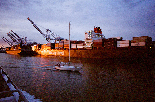
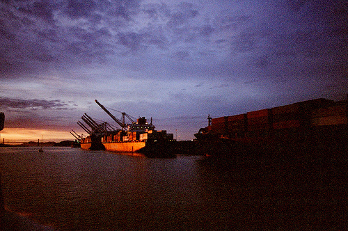
Pictures


Related Locations
Information of geographic nature is based on public data provided by geonames.org, CIA world facts book, Unesco, DBpedia and wikipedia. Weather is based on NOAA GFS.