-
You are here:
- Homepage »
- United States »
- California » Red Corral Census Designated Place

Red Corral Census Designated Place Destination Guide
Explore Red Corral Census Designated Place in United States
Red Corral Census Designated Place in the region of California is a town in United States - some 2,328 mi or ( 3747 km ) West of Washington , the country's capital city .
Current time in Red Corral Census Designated Place is now 08:47 AM (Tuesday) . The local timezone is named " America/Los Angeles " with a UTC offset of -7 hours. Depending on the availability of means of transportation, these more prominent locations might be interesting for you: Mt. Aukum, Bakersfield, Fiddletown, Fresno, and Lynn Park Acres. Since you are here already, make sure to check out Mt. Aukum . We saw some video on the web . Scroll down to see the most favourite one or select the video collection in the navigation. Where to go and what to see in Red Corral Census Designated Place ? We have collected some references on our attractions page.
Videos
PINE GROVE YOUTH CONSERVATION CAMP
CDCR's Division of Juvenile Justice offers a video tour of PINE GROVE YOUTH CONSERVATION CAMP, highlighting the rehabilitative environment and treatment programs that give youthful offenders the tools ..
mt. zion/jellystone 2008
mt. zion, gold country, amador county, black chasm, pinegrove, tabeau lake ..
Grinding Rock State Park - Holes
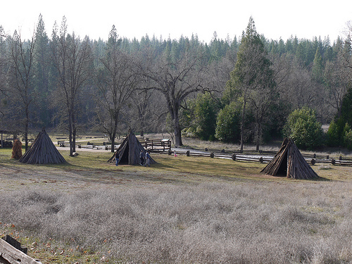
Spent the day checking out Grinding Rock State Park. Here are some of the holes that the native americans used to grind acorns. www.parks.ca.gov ..
Daffodil Hill
Dan & Tish at Daffodil Hill. It was the first weekend it was open and the flowers weren't really doing their thing yet. ..
Videos provided by Youtube are under the copyright of their owners.
Interesting facts about this location
Ranch House Estates, California
Ranch House Estates is an unincorporated community in Amador County, California. It lies at an elevation of 2546 feet (776 m).
Located at 38.41 -120.62 (Lat./Long.); Less than 1 km away
Pine Acres, California
Pine Acres is an unincorporated community in Amador County, California. It lies at an elevation of 2684 feet (818 m).
Located at 38.40 -120.64 (Lat./Long.); Less than 4 km away
Volcano, California
Volcano (formerly, Soldier's Gulch and The Volcano) is a census-designated place in Amador County, California. It lies at an elevation of 2070 feet (631 m). The population was 115 at the 2010 census. It is located at {{#invoke:Coordinates|coord}}{{#coordinates:38|26|35|N|120|37|51|W| | |name= }}, just north of Pine Grove. The town is registered as a California Historical Landmark. The community is in ZIP code 95689 and area code 209.
Located at 38.44 -120.63 (Lat./Long.); Less than 4 km away
Pine Grove, Amador County, California
Pine Grove is a census-designated place in Amador County, California. It lies at an elevation of 2513 feet (766 m). The population was 2,219 at the 2010 census. It is located at {{#invoke:Coordinates|coord}}{{#coordinates:38|24|47|N|120|39|32|W| | |name= }}, along State Route 88. The community is in ZIP code 95665 and area code 209. The current boundaries of Pine Grove include the former mining towns of Clinton and Irishtown. The town also is home to Indian Grinding Rock State Historic Park.
Located at 38.41 -120.66 (Lat./Long.); Less than 5 km away
Amador County, California
Amador County is a county located in the Sierra Nevada of the U.S. state of California. As of the 2010 census, the population was 38,091. The county seat is Jackson. Amador County bills itself as "The Heart of the Mother Lode" and lies within the Gold Country. There is a substantial viticultural industry in the county.
Located at 38.44 -120.66 (Lat./Long.); Less than 6 km away
Pictures

Related Locations
- Gold Mountain Census Designated Place (California)
- McClellan Park Census Designated Place (California)
- Meadowbrook Census Designated Place (California)
- Monument Hills Census Designated Place (California)
- Moskowite Corner Census Designated Place (California)
- North Gate Census Designated Place (California)
- Oak Shores Census Designated Place (California)
- Old Fig Garden Census Designated Place (California)
- Sereno Del Mar Census Designated Place (California)
- Sunny Slopes Census Designated Place (California)
- Sun Village Census Designated Place (California)
- Swall Meadows Census Designated Place (California)
- Woodlands Census Designated Place (California)
- Aetna Estates Census Designated Place (Colorado)
- Blue Sky Census Designated Place (Colorado)
- Brick Center Census Designated Place (Colorado)
Information of geographic nature is based on public data provided by geonames.org, CIA world facts book, Unesco, DBpedia and wikipedia. Weather is based on NOAA GFS.