-
You are here:
- Homepage »
- United States »
- Colorado » La Veta

La Veta Destination Guide
Delve into La Veta in United States
La Veta in the region of Colorado with its 800 residents is a city in United States - some 1,516 mi or ( 2439 km ) West of Washington , the country's capital .
Current time in La Veta is now 04:38 PM (Saturday) . The local timezone is named " America/Denver " with a UTC offset of -6 hours. Depending on your travel modalities, these larger destinations might be interesting for you: Alamo, Alamosa, Codo, Colorado Springs, and Cripple Creek. While being here, make sure to check out Alamo . We encountered some video on the web . Scroll down to see the most favourite one or select the video collection in the navigation. Are you curious about the possible sightseeing spots and facts in La Veta ? We have collected some references on our attractions page.
Videos
UP Challenger 3985 & the Ringling Bros Circus Train
Union Pacific Challenger 3985 Steam locomotive pulls the Ringling Bros Circus Train blue unit from Cheyenne to Denver on September 28, 2010 ..
Linda Hickman - Spanish Peaks Celtic Music Festival 2009
www.annlouiseramsey.com Linda Hickman, flute, and Roger Landes, bouzouki, at Colorado's 2009 Spanish Peaks International Celtic Music Festival in La Veta, Colorado - FOX Theater Concert Friday evening ..
Cell Phone Tower Protest In La Veta, Colorado, Part 1
Citizens of La Veta, Colorado, are concerned that a 180-foot cell phone tower on the ridge in front of the Spanish Peaks mountains, will hurt the economy of this beautiful community and forever tarnis ..
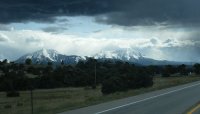
Sangre de cristos @ Evening
Sangre de cristo Mountains outside Laveta Colorado ..
Videos provided by Youtube are under the copyright of their owners.
Interesting facts about this location
La Veta, Colorado
La Veta is a Statutory Town in Huerfano County, Colorado, United States. The town population was 800 as of the 2010 census.
Located at 37.51 -105.01 (Lat./Long.); Less than 0 km away
West Spanish Peak
West Spanish Peak is a high mountain peak in the US state of Colorado. It is the higher of the two Spanish Peaks, two large igneous stocks which form an eastern outlier of the Culebra Range, a subrange of the Sangre de Cristo Mountains. Though not a fourteener, it is the twelfth most topographically prominent peak in the state. West Spanish Peak is the easternmost 4000 meter (13,123 ft) mountain peak in the United States.
Located at 37.38 -104.99 (Lat./Long.); Less than 14 km away
Cuchara, Colorado
Cuchara is an unincorporated community in Huerfano County, Colorado, United States. It is located near a former ski resort in the mountains south of the town of La Veta. Its altitude is 8,468 feet (2,581 m). Colorado State Highway 12 travels through Cuchara as it approaches Trinidad to the southeast. Cuchara is situated on the eastern slopes of the Sangre de Cristo Mountains in south-central Colorado. Cucharas Pass, at almost 10,000 feet, is a few miles south of the town of Cuchara.
Located at 37.38 -105.10 (Lat./Long.); Less than 16 km away
Apishapa River
Apishapa River is a 139-mile-long tributary of the Arkansas River that flows from a source near West Spanish Peak in southern Colorado. It joins the Arkansas east of Fowler, Colorado.
Located at 37.35 -105.02 (Lat./Long.); Less than 17 km away
Cordova Pass (Colorado)
Cordova Pass (11,248 feet) lies on the western shoulder of the West Spanish Peak, east of the Culebra Range of the Sangre de Cristo Mountains in southern Colorado. Cordova Pass lies just outside the Spanish Peaks Wilderness, a designated National Wilderness Area on the San Isabel National Forest. Cordova Pass is reached via the Apishapa Road, a leg of the Scenic Highway of Legends (a designated Colorado and National Forest Service scenic byway).
Located at 37.35 -105.03 (Lat./Long.); Less than 17 km away
Pictures
Related Locations
Information of geographic nature is based on public data provided by geonames.org, CIA world facts book, Unesco, DBpedia and wikipedia. Weather is based on NOAA GFS.


