-
You are here:
- Homepage »
- United States »
- Massachusetts » Gloucester

Gloucester Destination Guide
Touring Gloucester in United States
Gloucester in the region of Massachusetts with its 28,789 citizens is a city located in United States - some 421 mi or ( 677 km ) North-East of Washington , the country's capital city .
Time in Gloucester is now 01:07 AM (Thursday) . The local timezone is named " America/New York " with a UTC offset of -4 hours. Depending on your travel resources, these more prominent places might be interesting for you: Hartford, Barnstable, Beverly Farms, Boston, and Camp Sea Haven. Being here already, consider visiting Hartford . We collected some hobby film on the internet . Scroll down to see the most favourite one or select the video collection in the navigation. Check out our recommendations for Gloucester ? We have collected some references on our attractions page.
Videos
A Gloucester Christmas
Christmas in Gloucester,Ma by Cape Ann Images Visit: capeannimages.blogspot.com Music by Stephan Carroll....visit: www.stephancarroll.com ..
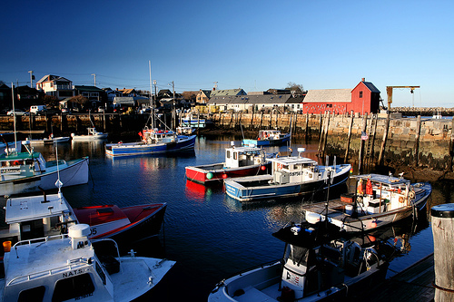
Gloucester Fishing Boats on the Move
Gloucester, Massachusetts Fishing boats passing the Paint Factory ..
SailGloucester2009
Views of SailGloucester 2009 by Cape Ann Images Visit: capeannimages.blogspot.com ..
7SeasWhaleWatch.flv
Whale Watch Gloucester Ma Whale Watching 01930 Cape Ann Whale Watch ..
Videos provided by Youtube are under the copyright of their owners.
Interesting facts about this location
Gloucester (MBTA station)
Gloucester is a passenger rail station on the Gloucester (Rockport) Branch of the MBTA Commuter Rail Newburyport/Rockport Line. It is located off Railroad Avenue and Washington Street in the downtown area of Gloucester, Massachusetts. The station consists of a single side platform serving the line's single track. The station has a mini-high platform, making it handicapped accessible.
Located at 42.62 -70.67 (Lat./Long.); Less than 1 km away
Babson Ledge
Babson Ledge is a small barren rock within the edge of the Western and Gloucester Harbors in Gloucester, Massachusetts. The rock is situated south of the Fort Point, Pavilion Beach, Blynman Canal, Route 127, and west of Rocky Neck.
Located at 42.61 -70.67 (Lat./Long.); Less than 1 km away
Gloucester, Massachusetts
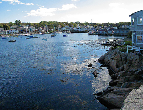
Gloucester /ˈɡlɒstər/ is a city on Cape Ann in Essex County, Massachusetts, in the United States. It is part of Massachusetts' North Shore. The population was 28,789 at the 2010 U.S. Census. An important center of the fishing industry and a popular summer destination, Gloucester consists of an urban core on the north side of the harbor and the outlying neighborhoods of Annisquam, Bay View, Lanesville, Folly Cove, Magnolia, Riverdale, East Gloucester and West Gloucester.
Located at 42.62 -70.68 (Lat./Long.); Less than 1 km away
Dogtown, Massachusetts
Dogtown (also Dogtown Commons or Dogtown Common or Dogtown Village) is an abandoned inland settlement on Cape Ann in Massachusetts. Once known as the Common Settlement and populated by respectable citizens, the area later known as Dogtown is divided between the city of Gloucester and the town of Rockport. It is in an area not particularly suited to agriculture, due to poor and very rocky soil.
Located at 42.64 -70.66 (Lat./Long.); Less than 2 km away
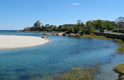
Cape Ann
Cape Ann is a rocky cape in northeastern Massachusetts on the Atlantic Ocean. The cape is located approximately 30 miles northeast of Boston and forms the northern edge of Massachusetts Bay. Cape Ann includes the city of Gloucester, and the towns of Essex, Manchester-by-the-Sea, and Rockport. It also includes the easternmost part of Beverly.
Located at 42.64 -70.63 (Lat./Long.); Less than 3 km away
Pictures
Related Locations
Information of geographic nature is based on public data provided by geonames.org, CIA world facts book, Unesco, DBpedia and wikipedia. Weather is based on NOAA GFS.