-
You are here:
- Homepage »
- Australia »
- New South Wales » Helensburgh

Helensburgh Destination Guide
Discover Helensburgh in Australia
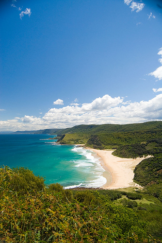
Helensburgh in the region of New South Wales with its 5,504 habitants is a town located in Australia - some 131 mi or ( 210 km ) North-East of Canberra , the country's capital .
Local time in Helensburgh is now 08:03 PM (Wednesday) . The local timezone is named " Australia/Sydney " with a UTC offset of 11 hours. Depending on your flexibility, these larger cities might be interesting for you: Waterfall, Sydney City, Stanwell Park, Otford, and Miranda. When in this area, you might want to check out Waterfall . We found some clip posted online . Scroll down to see the most favourite one or select the video collection in the navigation. Are you looking for some initial hints on what might be interesting in Helensburgh ? We have collected some references on our attractions page.
Videos
GARY THOMAS - Journey
[released 1997 by AIM AQUARIUS] ..
NEIGHBOURS FROM HELL - AUSTRALIAN STYLE
Do you have NEIGHBOURS FROM HELL like these or worse? Remember no one knows your friends, like your friends neighbours do.... ..
RoadTrek TNG Intro - WSBK and Beyond...
Road Trek TNG Intro - Les Trois Mousquetaires World Superbikes and Beyond... Introduction for an upcoming series showing on board camera footage recording a trip on a 2006 FJR1300 motorcycle from Sydn ..
Camden to Wollongong via Victor One
Victor One is the coastal route past Sydney Harbour - at 500 feet. ..
Videos provided by Youtube are under the copyright of their owners.
Interesting facts about this location
Helensburgh railway station
Helensburgh is a CityRail railway station on the South Coast railway line of New South Wales, Australia. It serves the small town of Helensburgh, although despite the name, the station is located in the neighbouring suburb of Lilyvale, which is some five minutes drive to the Helensburgh town centre and about 15–20 minutes by bus. The current Helensburgh station opened in 1915, replacing the original station which opened in 1889 on the original alignment of the Illawarra line at that location.
Located at -34.18 150.99 (Lat./Long.); Less than 0 km away
Otford railway station, New South Wales
Otford is a CityRail railway station on the South Coast railway line of New South Wales, Australia. It serves a sparsely populated area of Otford, New South Wales. It has two side platforms, on a sharp curve, which creates gap and step problems for passengers. The station is served by one train per hour for most of the time, with additional trains at weekday peak hours. The station has street access to both platforms, connected by an overbridge with stairs.
Located at -34.21 151.01 (Lat./Long.); Less than 4 km away
Otford, New South Wales
Otford is a former village, now satelite housing in the Otford Valley just 60 km to the south of the Sydney metropolitan area and north of the Illawarra and Wollongong in New South Wales, Australia. Otford is situated in the Otford Valley, north of Undola Ridge, Stanwell Park and Stanwell Tops. To the east of the valley is the coastal ridge and small community of Bulgo, also the name of a hill in the area and the former name of Otford.
Located at -34.22 151.00 (Lat./Long.); Less than 4 km away
Burning Palms, New South Wales
Burning Palms is an unbounded neighbourhood within the locality of Lilyvale and a beach in the Royal National Park, south of Sydney, Australia. It has a surf club and a local cabin community, and is a popular day-walk destination, along with the 'figure-8' rock pools on the rock shelf to the beach's south. It is accessed via a very steep, moderately difficult walk down (and up) the mountain through forest and grass plains. It is located in the area known as the Garawarra
Located at -34.18 151.05 (Lat./Long.); Less than 5 km away
Waterfall railway station, Sydney
Waterfall railway station is a Sydney railway station serving the suburb of Waterfall, New South Wales and is the last stop of the suburban section of the Illawarra line. Waterfall station also provides access to Camp Coutts, a large Scout campsite. The station opened in 1886, moving to its present location in 1905. Waterfall is used by an average of 540 commuters each weekday.
Located at -34.13 150.99 (Lat./Long.); Less than 5 km away
Pictures

Historical Weather
Related Locations
Information of geographic nature is based on public data provided by geonames.org, CIA world facts book, Unesco, DBpedia and wikipedia. Weather is based on NOAA GFS.