-
You are here:
- Homepage »
- Australia »
- New South Wales » Long Jetty

Long Jetty Destination Guide
Delve into Long Jetty in Australia
Long Jetty in the region of New South Wales with its 5,114 residents is a city in Australia - some 189 mi or ( 304 km ) North-East of Canberra , the country's capital .
Current time in Long Jetty is now 01:19 PM (Monday) . The local timezone is named " Australia/Sydney " with a UTC offset of 11 hours. Depending on your travel modalities, these larger destinations might be interesting for you: Wamberal North, Tumbi Vmbi, Sydney City, Lisarow, and Killarney. While being here, make sure to check out Wamberal North . We encountered some video on the web . Scroll down to see the most favourite one or select the video collection in the navigation. Are you curious about the possible sightseeing spots and facts in Long Jetty ? We have collected some references on our attractions page.
Videos
2010 central coast holiday edit
filmed at the entrance skate park and the slam factory. ..
The Entrance Country Music Festival 2012 Most voted male and female artist
www.skipfilms.com.au The Entrance Country Music Festival 2012 most voted male and female artist of the three days of the Central Coast Country Music Festival 2012 Amber Lawrence & Craig Morrison Centr ..
Wamberal Cottage Wamberal
Wamberal Cottage 1 ..
Pelican Feeding at the Entrance
Pelican feeding is a tourist attraction at The Entrance on the Central Coast of NSW. Background music = "Dare to be Different" by Blair Booth ..
Videos provided by Youtube are under the copyright of their owners.
Interesting facts about this location
Long Jetty, New South Wales
Long Jetty is a suburb of the Central Coast region of New South Wales, Australia, located on a peninsula between Tuggerah Lake and the Pacific Ocean south of The Entrance. It is part of the Wyong Shire local government area.
Located at -33.36 151.49 (Lat./Long.); Less than 1 km away
Blue Bay, New South Wales
Blue Bay is a suburb of the Central Coast region of New South Wales, Australia, located on a peninsula between Tuggerah Lake and the Pacific Ocean south of The Entrance. It is part of the Wyong Shire local government area.
Located at -33.35 151.50 (Lat./Long.); Less than 2 km away
The Entrance, New South Wales
The Entrance is a district centre and town of the Central Coast region of New South Wales, Australia. It is part of the Wyong Shire local government area. At the 2006 census, The Entrance had a population of 2,632 people. The town occupies an area of land that is bounded by water on three sides. The Entrance gains it name from the channel that runs along much of its northern border that is the entrance to The Tuggerah Lakes.
Located at -33.35 151.50 (Lat./Long.); Less than 3 km away
The Entrance Bridge
The Entrance Bridge joins the suburbs of The Entrance and The Entrance North on the Central Coast of New South Wales, Australia, passing over The Entrance Channel. The road forms part of Wilfred Barret Drive. The Entrance Bridge was originally a wooden single lane bridge with bypass bays at intervalas that allowed traffic travelling in the opposite direction to pass. It was opened in 1934.
Located at -33.34 151.50 (Lat./Long.); Less than 4 km away
Chittaway Bay, New South Wales
Chittaway Bay is a suburb of the Central Coast region of New South Wales, Australia. It is part of the Wyong Shire local government area. The main road through the suburb, Chittaway Road, has on it a four star motel, service station, and a shopping centre known as Chittaway Centre, it also has a pub called Chittaway Bay Tavern, but more commonly known to locals as "The Tav".
Located at -33.33 151.45 (Lat./Long.); Less than 5 km away
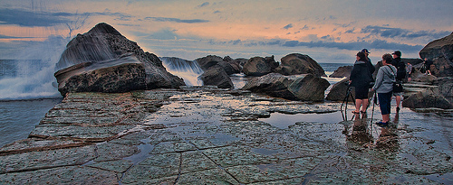
Pictures
Historical Weather
Related Locations
Information of geographic nature is based on public data provided by geonames.org, CIA world facts book, Unesco, DBpedia and wikipedia. Weather is based on NOAA GFS.