Explore Howden in Australia
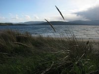
Howden in the region of Tasmania is a town in Australia - some 544 mi or ( 875 km ) South of Canberra , the country's capital city .
Current time in Howden is now 04:51 PM (Monday) . The local timezone is named " Australia/Hobart " with a UTC offset of 11 hours. Depending on the availability of means of transportation, these more prominent locations might be interesting for you: Woodbridge, Warrane, Ridgeway, Kettering, and Hobart. Since you are here already, make sure to check out Woodbridge . We saw some video on the web . Scroll down to see the most favourite one or select the video collection in the navigation. Where to go and what to see in Howden ? We have collected some references on our attractions page.
Videos
D'Entrecasteaux - The Frence Hotel - located just south of Hobart, Tasmania, Australia
Hobart Luxury Accommodation. D'Entrecasteaux is a small and intimate, luxury hotel, wedding and function centre, located 15 minutes from Hobart and Sullivans Cove attractions. Hobart, is the charming ..
30 Days in Oz: Blair, MONA, Tasmania
Want to see a machine that pumps out poo?! Check out Blair as he takes you around MONA (Museum of Old and New Art mona.net.au -- the hot opening of 2011 and famous for its quirky exhibits. Make sure y ..
TIGER CHOIR - Ephemeral City
First single from Tiger Choir's UNICYCLES, out now on vinyl and digital! itunes.apple.com tigerchoir.bandcamp.com Directed by Rob Harrison and Tiger Choir. tigerchoir.bandcamp.com www.facebook.com/tig ..
SCUBA Tasmania: Blackmans Bay
A few scenes from a dive at Blackmans Bay, south of Hobart on 14-02-2009. Visibility was less than ideal on the day, and please excuse the shaky camera work! Camera used was a Sony HDR-SR7 fitted with ..
Videos provided by Youtube are under the copyright of their owners.
Interesting facts about this location
Margate, Tasmania
Margate is a small seaside town on the Channel Highway between North-West Bay and the Snug Tiers, 7 kilometres south of Kingston in Tasmania, Australia. At the 2006 census, Margate had a population of 1,368. Although more people live in the immediate region around the town. Margate is part of the Kingborough Council and is a frequent 'pit-stop' for those travelling south towards Snug, Kettering or Bruny Island. Vineyards, grazing fields and stands of trees surround the town and its approaches.
Located at -43.03 147.26 (Lat./Long.); Less than 3 km away
Blackmans Bay, Tasmania
Blackmans Bay is a beachside suburb of Hobart, Tasmania, Australia. Blackmans Bay south of Hobart was named after a James Blackman who occupied land there in the 1820s while another "Blackman Bay", near Dunalley (also in Tasmania) was so named in 1642 because of the presence of Aboriginal people. The town is located adjacent to Kingston, and is approximately fourteen kilometres south of Hobart, to which it is connected by the Southern Outlet motorway.
Located at -43.00 147.32 (Lat./Long.); Less than 3 km away
Huntingfield, Tasmania
Huntingfield is a suburb of the greater Hobart area, capital of Tasmania, Australia. It is just south of Kingston. The area is fairly new, with most homes being less than ten years old. Vodafone's Tasmanian call centre is located in Huntingfield, as is Tarremah Steiner School and Kingborough Family Church. McDougalls Power Equipment, the states largest Husqvarna dealer, is also located here.
Located at -42.99 147.29 (Lat./Long.); Less than 4 km away
Maranoa Heights, Tasmania
Maranoa Heights is a residential neighbourhood of the suburb of Kingston in the greater Hobart area of Tasmania, Australia. It is largely within the southern part of the area contained by the B68 Channel Highway, the C628 Roslyn Avenue and Algona Road. Maranoa Heights contains large areas of recreational woodland accessed by walking tracks and overlooks the coastal suburbs of Kingston Beach and Blackmans Bay. Maranoa Heights is home to the Boronia Hill Flora Track.
Located at -42.99 147.31 (Lat./Long.); Less than 4 km away
Australian Marine Mammal Research Centre
The Australian Marine Mammal Research Centre or AMMRC was established in 1996 as a co-operative centre of the University of Sydney and the Zoological Parks Board of New South Wales.
Located at -42.99 147.29 (Lat./Long.); Less than 4 km away
Pictures
Historical Weather
Related Locations
Information of geographic nature is based on public data provided by geonames.org, CIA world facts book, Unesco, DBpedia and wikipedia. Weather is based on NOAA GFS.


