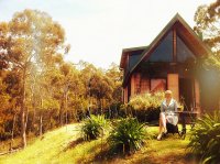
Explore Kettering in Australia
Kettering in the region of Tasmania with its 1,178 inhabitants is a town in Australia - some 551 mi or ( 887 km ) South of Canberra , the country's capital city .
Current time in Kettering is now 08:31 PM (Wednesday) . The local timezone is named " Australia/Hobart " with a UTC offset of 11 hours. Depending on the availability of means of transportation, these more prominent locations might be interesting for you: Opossum Bay, Middleton, Margate, Kingston Beach, and Kingston. Since you are here already, make sure to check out Opossum Bay . We saw some video on the web . Scroll down to see the most favourite one or select the video collection in the navigation. Where to go and what to see in Kettering ? We have collected some references on our attractions page.
Videos
AISOI 2010 - Le Sacre du Printemps (The Rite Of Spring)
AISOI is an intensive two-week period, which combines individual and sectional tutoring from some of Australia's finest orchestral musicians, and the opportunity to work under internationally acclaime ..
What is Expedition Class?
Starting with the 4900km sea kayak journey from Hobart to Thursday Island, this is a really short explanation of how Expedition Class is making adventure learning... well, adventurous! ..
Breeding THC part 1 (1st half) - 2004 Tas hip-hop doco
Breeding THC: An insight into the Tasmanian Hip-hop Collective. Produced in 2004 at Rosny College, this 17-min documentary introduces a brief history of Tasmanian hip-hop; (some of) the artists, devel ..
AISOI - Overview 2010
AISOI is an intensive two-week period, which combines individual and sectional tutoring from some of Australia's finest orchestral musicians, and the opportunity to work under internationally acclaime ..
Videos provided by Youtube are under the copyright of their owners.
Interesting facts about this location
Kettering, Tasmania
Kettering is a coastal town on the D'Entrecasteaux Channel (37 km south of Hobart) opposite Bruny Island, Tasmania, Australia. At the 2011 census, Kettering had a population of 984.
Located at -43.12 147.27 (Lat./Long.); Less than 2 km away
Woodbridge, Tasmania
Woodbridge is a town in southern Tasmania, Australia 38 kilometres south of the state capital, Hobart. At the 2006 census, Woodbridge had a population of 271.
Located at -43.17 147.23 (Lat./Long.); Less than 4 km away
Snake Island (Tasmania)
Snake Island is a small, low-lying island in south-eastern Australia. It is part of the Betsey Island Group, lying close to the south-eastern coast of Tasmania around the entrance to the River Derwent.
Located at -43.17 147.28 (Lat./Long.); Less than 5 km away
Green Island (Tasmania)
Green Island is a small island nature reserve with an area of 4.17 ha in south-eastern Australia. Lying close to the south-eastern coast of Tasmania around the entrance to the River Derwent. It lies in the D'Entrecasteaux Channel.
Located at -43.18 147.28 (Lat./Long.); Less than 7 km away
Snug, Tasmania
Snug is a small coastal town on the Channel Highway 30 kilometres south of Hobart in Tasmania, Australia. At the 2006 census, Snug had a population of 881. Snug is a part of the Municipality of Kingborough.
Located at -43.07 147.27 (Lat./Long.); Less than 7 km away
Pictures
Historical Weather
Related Locations
Information of geographic nature is based on public data provided by geonames.org, CIA world facts book, Unesco, DBpedia and wikipedia. Weather is based on NOAA GFS.


