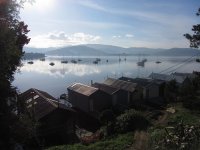
Explore Old Beach in Australia
Old Beach in the region of Tasmania with its 2,447 inhabitants is a town in Australia - some 527 mi or ( 849 km ) South of Canberra , the country's capital city .
Current time in Old Beach is now 07:51 PM (Friday) . The local timezone is named " Australia/Hobart " with a UTC offset of 11 hours. Depending on the availability of means of transportation, these more prominent locations might be interesting for you: Warrane, Lindisfarne, Hobart, Granton, and Glenorchy. Since you are here already, make sure to check out Warrane . We encountered some video on the web . Scroll down to see the most favourite one or select the video collection in the navigation. Where to go and what to see in Old Beach ? We have collected some references on our attractions page.
Videos
Discover Tasmania TV Commercial and Promo - 2010
A World Apart Not A World Away ..
30 Days in Oz: Greg, Bonorong, Tasmania
Greg Irons is the owner of the Bonorong Wildlife Sanctuary (www.bonorong.com.au in Tasmania. Here, he looks after Tassie Devils as well as other injured and orphaned animals. Check out a day in his li ..
Derwent Valley Railway charter train
Tasmanian Transport Museum locomotive Y4 leads Derwent Valley Railway's Y2 and train between Derwent Park and Sunderland Street in preparation for an evening charter trip on 1 March 2003. This was Y4' ..
Stuart MacGill wines about Moorilla
If you head to Moorilla, be prepared for one of the most spectacular museums in Australia... and the pink fizz... YUM! ..
Videos provided by Youtube are under the copyright of their owners.
Interesting facts about this location
Old Beach, Tasmania
Old Beach is a suburb of Hobart based in the municipality of Brighton, Tasmania, Australia. It is the location of the Baskerville Raceway.
Located at -42.77 147.27 (Lat./Long.); Less than 0 km away
Claremont, Tasmania
Claremont is a suburb of the City of Glenorchy, part of the greater Hobart area, Tasmania, Australia. It is named after Claremont House, which was built in the 1830s by local settler Henry Bilton, who named it after one of the royal homes of England. Claremont was the home of an Army training facility during World War I, but this was moved to Brighton some time before World War II. At that time Claremont consisted of only a few houses and farms.
Located at -42.79 147.25 (Lat./Long.); Less than 2 km away
Claremont Village
Claremont Village is a small sub-regional shopping centre located on the corner of Main Road and Box Hill Road, in Claremont, Tasmania. The shopping centre contains a Woolworths supermarket, a Chickenfeed discount store and several speciality shops. The Claremont Village Shopping Centre was the first fully enclosed centre in Tasmania.
Located at -42.79 147.25 (Lat./Long.); Less than 2 km away
Claremont College
For the consortium of seven colleges located in Claremont, California, refer to Claremont Colleges. Claremont College opened in 1990 as a senior secondary Government school in Tasmania, Australia, for students in Years 11 and 12. It provides a full range of courses, preparing students for university, TAFE, traineeships and employment. Its 900 students study either on-campus or off-campus.
Located at -42.80 147.25 (Lat./Long.); Less than 2 km away
Berriedale, Tasmania
Berriedale is a suburb in the northern suburbs of Hobart, capital of Tasmania, Australia. It is in the local government area of City of Glenorchy. The suburb is situated between the suburbs of Chigwell and Rosetta. There are no educational institutions within Berriedale, however there are primary schools in both neighbouring suburbs and a High school in Rosetta.
Located at -42.81 147.26 (Lat./Long.); Less than 4 km away
Pictures
Historical Weather
Related Locations
Information of geographic nature is based on public data provided by geonames.org, CIA world facts book, Unesco, DBpedia and wikipedia. Weather is based on NOAA GFS.


