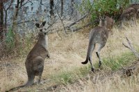
Touring Panton Hill in Australia
Panton Hill in the region of Victoria is a city located in Australia - some 271 mi or ( 435 km ) South-West of Canberra , the country's capital city .
Time in Panton Hill is now 06:24 AM (Friday) . The local timezone is named " Australia/Melbourne " with a UTC offset of 11 hours. Depending on your travel resources, these more prominent places might be interesting for you: Yering, Yan Yean, Wonga Park, Upper Diamond Creek, and Smith Gully Road. Being here already, consider visiting Yering . We collected some hobby film on the internet . Scroll down to see the most favourite one or select the video collection in the navigation. Check out our recommendations for Panton Hill ? We have collected some references on our attractions page.
Videos
MasterClass Unearthed
Festival friends Matt Preston, Matt Wilkinson (Pope Joan) and Janne Apelgren (The Age, National Food and Wine Editor) share what earth means to them, from understanding the provenance of food and wine ..
McDonald's Sydney Stack Hamburger
For the period of the London Olympic games, McDonalds are offering special menu items, First up to try is this Sydney Stack. An all Australian hamburger - with beetroot! ..
St Andrews Summer Solstice journey
LLOYD GODMAN - an animated sequence of a summer solstice photographic journey at St Andrews Victoria Australia by Lloyd Godman with original music by Alex Hayes from Planet in Space ..
Lifestyle Property for sale - Kangaroo Ground, Melbourne
www.lifestyle-home-melbourne.com.au Watch this tried intro video explaining what this fantastic home offers. Located just 35 minutes from the Melbourne CBD, 30 minutes from Melbourne International Air ..
Videos provided by Youtube are under the copyright of their owners.
Interesting facts about this location
Panton Hill, Victoria
Panton Hill is a town in Victoria, Australia, 32 km north-east from Melbourne's Central Business District. Its Local Government Area is the Shire of Nillumbik. At the 2011 Census, Panton Hill had a population of 1,158.
Located at -37.64 145.24 (Lat./Long.); Less than 0 km away
Shire of Nillumbik
The Shire of Nillumbik is a local government area in Victoria, Australia. It contains outer northern suburbs of Melbourne and rural localities beyond the urban area. It has an area of 435 square kilometres and at the 2011 Census, the Shire had a population of 60,342. It was formed in 1994 from the merger of parts of the Shires of Eltham, Diamond Valley, Healesville and the City of Whittlesea. The Shire uses the tag-line The Green Wedge Shire.
Located at -37.63 145.23 (Lat./Long.); Less than 1 km away
Smiths Gully, Victoria
Smiths Gully is a town in Victoria, Australia, 35 km north-east from Melbourne's Central Business District. Its Local Government Area is the Shire of Nillumbik. At the 2011 Census, Smiths Gully had a population of 391. Smith Gully Road Post Office opened in 1902, was renamed Smith Gully in 1964 and Smiths Gully later that year.
Located at -37.62 145.26 (Lat./Long.); Less than 3 km away
Watsons Creek, Victoria
Watsons Creek is a bounded locality in Victoria, Australia, 31 km north-east of Melbourne's Central Business District. Its Local Government Area is the Shire of Nillumbik. It lies to the north and west of the Eltham-Yarra Glen Road.
Located at -37.67 145.26 (Lat./Long.); Less than 4 km away
Hurstbridge, Victoria
Hurstbridge is a town in Victoria, Australia, 26 km north-east from Melbourne's Central Business District. Its Local Government Area is the Shire of Nillumbik. At the 2011 Census, Hurstbridge had a population of 3,511. Hurstbridge lies at the junction of Diamond Creek and Arthurs Creek.
Located at -37.64 145.20 (Lat./Long.); Less than 4 km away
Pictures
Historical Weather
Related Locations
Information of geographic nature is based on public data provided by geonames.org, CIA world facts book, Unesco, DBpedia and wikipedia. Weather is based on NOAA GFS.


