
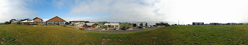
Touring Rhyll in Australia
Rhyll in the region of Victoria is located in Australia - some 305 mi or ( 491 km ) South-West of Canberra , the country's capital city .
Time in Rhyll is now 01:44 PM (Monday) . The local timezone is named " Australia/Melbourne " with a UTC offset of 11 hours. Depending on your budget, these more prominent places might be interesting for you: Ventnor, Tankerton, Stony Point, Somers, and Melbourne. Being here already, consider visiting Ventnor . We collected some hobby film on the internet . Scroll down to see the most favourite one or select the video collection in the navigation. Check out our recommendations for Rhyll ? We have collected some references on our attractions page.
Videos
Australia Trip 2007: Phillip Island Wildlife Refuge
More kangaroos. A walk through a mob of slightly more cautious marsupials. ..
Australien 2009, Schnabeligel im Wildlifepark Phillip Island
Ein Schnabeligel im Phillip Island Wildlife Park in Australien. Mein Urlaub im März 2009. ..
Camp No Fear 2011 - Wanted Alive (HD)
Living off love+air. Soaked in adrenaline. Hand-crafted to push the upper limits of a generation.... WWW.CAMPNOFEAR.COM Jan 20-23, 2011. Years 7-13. Phillip Island Precariously wedged between a fresh ..
Penguin Parade - Cowes, Phillip Island, Victoria, Australia
tripwow.tripadvisor.com - Created at TripWow by TravelPod Attractions (a TripAdvisor™ company) Penguin Parade Cowes Read more at: www.travelpod.com Travel blogs from Penguin Parade: - "... Today I'm l ..
Videos provided by Youtube are under the copyright of their owners.
Interesting facts about this location
Rhyll, Victoria
Rhyll is a small fishing town on Phillip Island in Victoria, Australia. It is located in the north-east corner of the island. It is named after Rhyl, a holiday resort in North Wales, Great Britain. At the 2011 census, Rhyll had a population of 674. The first European to arrive in the area was George Bass, who landed in 1798 to make repairs to his ship. He returned in the same year with Matthew Flinders and a memorial for this landing is maintained close to Rhyll pier.
Located at -38.46 145.30 (Lat./Long.); Less than 0 km away
Silverleaves, Victoria
Silverleaves is a small town on Phillip Island situated east of Cowes, Victoria. At the 2006 census, Silverleaves had a population of 187.
Located at -38.45 145.26 (Lat./Long.); Less than 3 km away
Shire of Phillip Island
The Shire of Phillip Island was a local government area in Western Port about 120 kilometres south of Melbourne, the state capital of Victoria, Australia. The shire covered an area of 101.05 square kilometres, and existed from 1928 until 1994.
Located at -38.45 145.25 (Lat./Long.); Less than 5 km away
Cowes, Victoria
Cowes is the main township on Phillip Island in the Gippsland region of Victoria, Australia. It is about two hours' drive from Melbourne and can also be reached by ferry from Stony Point on the Mornington Peninsula. Cowes is located on the northern side of Phillip Island and faces towards French Island and the Mornington Peninsula. At the 2011 census, Cowes had a population of 4053.
Located at -38.45 145.24 (Lat./Long.); Less than 5 km away
Wimbledon Heights, Victoria
Wimbledon Heights is a small town in the center of Phillip Island in Victoria, Australia. It consists of a small residential block surrounded by farmland and is located north of the Phillip Island Grand Prix track. At the 2006 census, Wimbledon Heights had a population of 386.
Located at -38.48 145.23 (Lat./Long.); Less than 6 km away
Pictures

Historical Weather
Related Locations
Information of geographic nature is based on public data provided by geonames.org, CIA world facts book, Unesco, DBpedia and wikipedia. Weather is based on NOAA GFS.