
Discover Rosebud in Australia
Rosebud in the region of Victoria is a town located in Australia - some 315 mi or ( 508 km ) South-West of Canberra , the country's capital .
Local time in Rosebud is now 10:06 PM (Tuesday) . The local timezone is named " Australia/Melbourne " with a UTC offset of 11 hours. Depending on your flexibility, these larger cities might be interesting for you: Shoreham, Rye, Red Hill South, Red Hill, and Mount Martha. When in this area, you might want to check out Shoreham . We found some clip posted online . Scroll down to see the most favourite one or select the video collection in the navigation. Are you looking for some initial hints on what might be interesting in Rosebud ? We have collected some references on our attractions page.
Videos
Eco Tourer and Coxy
Coxy from Coxy's Big Break checks out an Eco Tourer ..
Suzuki GSX 1400
A trip to Arthurs Seat on the Mornington Peninsula a nice afternoon. ..
Admiral Motor Inn Self Contained Apartments and Motel in Rosebud Victoria
Admiral Motor Inn is a family run motel in Rosebud Victoria. Admiral makes a great base of accommodation to see the Mornington Peninsula. You are a short drive to Sorrento and Sorrento Ferry, Red Hill ..
Mornington Peninsula Australia
Mornington Peninsula Australia. My own photos, music by enya. ..
Videos provided by Youtube are under the copyright of their owners.
Interesting facts about this location
Rosebud Primary School
Rosebud Primary School is a primary school in Rosebud, Victoria, Australia, established in 1884.
Located at -38.35 144.90 (Lat./Long.); Less than 0 km away
Rosebud, Victoria
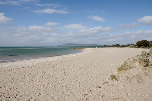
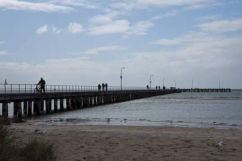
Rosebud is a sea side town on the Mornington Peninsula, Victoria, Australia located approximately 75 km southeast of the Melbourne City Centre. It is wedged between the lower slopes of Arthurs Seat, the shores of Port Phillip Bay and the plains of Boneo. Its Local Government Area is the Shire of Mornington Peninsula. Rosebud is a very popular tourist resort with families who appreciate its sandy beaches and shallow waters.
Located at -38.36 144.92 (Lat./Long.); Less than 2 km away
McCrae, Victoria
McCrae is a suburb of Melbourne, Victoria, Australia. Its local government area is the Shire of Mornington Peninsula. McCrae is known for the McCrae Lighthouse. No longer an operating lighthouse, it marked the turning point for shipping in the main navigational channels between Port Phillip Heads and Melbourne. Recently a new shopping center called McCrae Plaza opened and it included a Bilo Supermarket, which later became a Coles Supermarket.
Located at -38.35 144.92 (Lat./Long.); Less than 2 km away
McCrae Homestead
McCrae Homestead is an historic property located in McCrae, Victoria, Australia. It was built at the foot of Arthurs Seat, a small mountain, near the shores of Port Phillip in 1844 by Andrew McCrae, a lawyer, and his wife Georgiana Huntly McCrae (15 March 1804 – 24 May 1890), a portrait artist of note. The homestead is under the care of the National Trust of Australia, and is open to the public. Volunteers who are knowledgeable about the history of the house conduct tours and answer questions.
Located at -38.35 144.93 (Lat./Long.); Less than 3 km away
Rosebud West, Victoria
Rosebud West is a suburb in Melbourne, Victoria, Australia. Its Local Government Area is the Shire of Mornington Peninsula. Rosebud West Post Office opened on 12 January 1938 and closed around 1996.
Located at -38.38 144.87 (Lat./Long.); Less than 4 km away
Pictures


Historical Weather
Related Locations
Information of geographic nature is based on public data provided by geonames.org, CIA world facts book, Unesco, DBpedia and wikipedia. Weather is based on NOAA GFS.