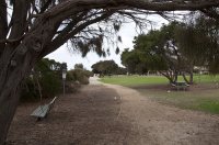
Delve into Saint Andrews Beach in Australia
Saint Andrews Beach in the region of Victoria is located in Australia - some 321 mi or ( 517 km ) South-West of Canberra , the country's capital .
Local time in Saint Andrews Beach is now 10:13 AM (Sunday) . The local timezone is named " Australia/Melbourne " with a UTC offset of 11 hours. Depending on your mobility, these larger destinations might be interesting for you: Sorrento, Portsea, Melbourne, Dromana, and McCrae. While being here, you might want to check out Sorrento . We discovered some clip posted online . Scroll down to see the most favourite one or select the video collection in the navigation. Are you curious about the possible sightseeing spots and facts in Saint Andrews Beach ? We have collected some references on our attractions page.
Videos
Cute Groodle or Golden Doodle Puppy's first trip to the beach (1)
Ted swimming down at Rye foreshore ..
Mornington Peninsula Australia
Mornington Peninsula Australia. My own photos, music by enya. ..
NetBookings Tour Booking System
Tutorial on teh NetBookings Tour Booking System. Schedule tours with the Tour Wizard and then make bookings for your tours ..
Sand Sculpture 2007 Australia. Camelot.
Sand Sculpture 2007 Australia. The making of Camelot, King Arthur's castle. Held on foreshore at Rye beach Victoria Australia. Royalty music by Neverland ..
Videos provided by Youtube are under the copyright of their owners.
Interesting facts about this location
St Andrews Beach, Victoria
St Andrews Beach is located on the Bass Strait side of the southern Mornington Peninsula and it is south of Rye. It was first subdivided in the 1950s and the subdivision was originally marketed as "Capri by the Sea". In the 1960s a golf course (since closed) was constructed and the subdivision was remarketed as St. Andrews by the Sea.
Located at -38.42 144.83 (Lat./Long.); Less than 1 km away
Fingal, Victoria
Fingal is a rural locality of the Mornington Peninsula abutting Bass Strait along Gunnamatta Beach and lying between the suburbs of Rye and Cape Schanck. Its Local Government Area is the Shire of Mornington Peninsula.
Located at -38.42 144.86 (Lat./Long.); Less than 3 km away
Rye, Victoria
Rye is a seaside resort town, approximately 83 km south of Melbourne, Victoria, Australia, on the Mornington Peninsula, Victoria, Australia. Its bay beach is popular with swimmers, fishermen, yachtsmen and kitesurfers. Its ocean beach (which is not patrolled) is also popular with surfers. Its Local Government Area is the Shire of Mornington Peninsula.
Located at -38.38 144.84 (Lat./Long.); Less than 4 km away
Tootgarook, Victoria
Tootgarook is located approximately 81 km from Melbourne, Victoria, Australia. Its local government area is the Shire of Mornington Peninsula.
Located at -38.37 144.85 (Lat./Long.); Less than 5 km away
Boneo, Victoria
Boneo is a rural locality south of Melbourne, Victoria, Australia, south of and inland from Rosebud on the Mornington Peninsula. Its local government area is the Shire of Mornington Peninsula.
Located at -38.41 144.89 (Lat./Long.); Less than 6 km away
Pictures
Historical Weather
Related Locations
Information of geographic nature is based on public data provided by geonames.org, CIA world facts book, Unesco, DBpedia and wikipedia. Weather is based on NOAA GFS.


