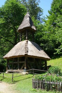
Discover Frohnleiten in Austria
Frohnleiten in the region of Styria with its 6,629 habitants is a place located in Austria - some 81 mi or ( 131 km ) South-West of Vienna , the country's capital .
Local time in Frohnleiten is now 08:27 PM (Wednesday) . The local timezone is named " Europe/Vienna " with a UTC offset of 1 hours. Depending on your mobility, these larger cities might be interesting for you: Vienna, Wannersdorf, Ungersdorf, Ubelbach, and Stattegg. When in this area, you might want to check out Vienna . We discovered some clip posted online . Scroll down to see the most favourite one or select the video collection in the navigation. Are you looking for some initial hints on what might be interesting in Frohnleiten ? We have collected some references on our attractions page.
Videos
Preview: Die Steiermark
Sozial. Sicher. Stark. Die Steiermark. Trailer zum Film. Weitere Informationen über das Projekt: dkmotion.com www.team2010.at shot on: hpx171e, hpx301e, ex3, letus ultimate, nikon and zeiss lenses ..
BikeCityGuide - Option 1 - Auf Insider Touren Städte besser kennen lernen
www.bikecityguide.org Städte intensiver entdecken. Wir bieten in vielen Städten Insider Rad-Touren, von Experten kreiiert. Hier kann man Städte, die eigene oder fremde, intensiv am Rad entdecken. Imme ..
Rakousko Medvědí soutěska
..
1. Musikantenstammtisch auf Reisen mit dem Zug von Peggau - Bad Radkersburg, Rene Kogler
14 Musikgruppen der Spitzenklasse Die Rechberger, Juhej Oberkrainer, Die Paggerbuam, Harmonika Weltmeister Rene Kogle, Steiraseiten, Die Huafschneida, Brunner Vagabunden, die flottn Steira, Zirbitz Bu ..
Videos provided by Youtube are under the copyright of their owners.
Interesting facts about this location
Styria
Styria is a state or Bundesland, located in the southeast of Austria. In area it is the second largest of the nine Austrian federated states, covering 16,401 km². It borders Slovenia as well as the other Austrian states of Upper Austria, Lower Austria, Salzburg, Burgenland, and Carinthia. The population (as of 2011) was 1,210,700. The capital city is Graz (265,000 inhabitants).
Located at 47.25 15.17 (Lat./Long.); Less than 11 km away
Schöckl Transmitter
Schöckl Transmitter is a facility for FM- and TV-transmission on the Schöckl Mountain in Steiermark, Austria. It uses as an antenna tower, a 100 metre high lattice tower, which was built in 1956. The tower of Schöckl transmitter was originally completely free-standing, but it was in recent times additionally guyed.
Located at 47.20 15.46 (Lat./Long.); Less than 13 km away
Mürz
The Mürz is a river in Austria. It begins north of the Schneealpe in Lower Austria, flows into Styria, and meets the Mur River after 98 km in Bruck an der Mur. Its headwaters end at Mürzzuschlag. Along its course are the tracks of the Southern Railway as well as the Semmering Highway.
Located at 47.40 15.28 (Lat./Long.); Less than 15 km away
Straßengel
Straßengel is a village a few kilometres north of Graz, Austria, featuring a pilgrimage church on top of a hill. This church hosts a piece of tree root, loosely shaped like Jesus on the cross. This root is not displayed openly, but shown to people on request. The closest railway station is "Judendorf-Straßengel" and the hill is in walking distance from the station.
Located at 47.12 15.35 (Lat./Long.); Less than 17 km away
Rabnitzbach
Rabnitzbach {{#invoke:InfoboxImage|InfoboxImage|image=|size=|sizedefault=288px|alt=}} {{#invoke:InfoboxImage|InfoboxImage|image=|size=|sizedefault=288px|alt=}}Origin near mount SchöcklMouth Rába near GleisdorfBasin countries StyriaLength 21 km The Rabnitzbach (also Rabnitz) is one of the source rivers of the Rába. It originates near Mount Schöckl and flows in south-east direction to Gleisdorf where it merges with the Rába. The brook reaches a length of app. 21 kilometers.
Located at 47.17 15.52 (Lat./Long.); Less than 19 km away
Pictures
Historical Weather
Related Locations
Information of geographic nature is based on public data provided by geonames.org, CIA world facts book, Unesco, DBpedia and wikipedia. Weather is based on NOAA GFS.


