-
You are here:
- Homepage »
- Austria »
- Vorarlberg » Schnifis

Schnifis Destination Guide
Explore Schnifis in Austria
Schnifis in the region of Vorarlberg is a town in Austria - some 316 mi or ( 509 km ) West of Vienna , the country's capital city .
Current time in Schnifis is now 10:27 AM (Sunday) . The local timezone is named " Europe/Vienna " with a UTC offset of 1 hours. Depending on the availability of means of transportation, these more prominent locations might be interesting for you: Zurich, Winterthur, Schnifis, Rankweil, and Gotzis. Since you are here already, make sure to check out Zurich . We saw some video on the web . Scroll down to see the most favourite one or select the video collection in the navigation. Where to go and what to see in Schnifis ? We have collected some references on our attractions page.
Videos
Laterns
Laterns-Gapfohl, ein gemütliches Familienskigebiet, ist vom Rheintal aus in einer Viertelstunde zu erreichen. Eine wunderbar angelegte Rodelbahn und gratis Kinderbetreuung im phantasievollen Kinderlan ..
FiFA 11 - 50 METER TOR !
- ABONNIEREN - Volley aus 50m entfernung, in der Arena - High Defination FiFA 11 - FiFA 11 - FiFA 11 - FiFA 11 - FiFA 11 - FiFA 11 - FiFA 11 - FiFA 11 ..
Nenzing
Die vielseitige und abwechslungsreiche Ferien- und Freizeitregion Nenzing-Gurtis hat für jeden Gast etwas zu bieten, ob Schwimmen im Walgaubad, Bergwandern oder Verweilen im europaweit prämierten 5-St ..
Laterns - Egge - Bonacker - Innerlaterns
Laterns ist ein typisches Walserdorf in einem beliebten Wandergebiet. Mit einem kleinen Golfplatz, der Sommerrodelbahn und einem Trekkinghof ist das Freizeitangebot des Bergdorfes überraschend vielsei ..
Videos provided by Youtube are under the copyright of their owners.
Interesting facts about this location
Meng (river)
The Meng River originates from the "Red Wall" - gorge at 2,390 meters above sea level. It flows through the Gamperdonatal in a northern direction, where it unites in the municipality of Nenzing with the Ill. It reaches a length of 18 kilometers. The Gampbach with 5 kilometers of length approaches from the right side out of the Gamptal. Gampbach merges in the middle part with the Meng River.
Located at 47.18 9.72 (Lat./Long.); Less than 4 km away
Galina (Austria)
The Galina River originates near the „Rossboden“ 2,060 metres above Sea Level. It is one of the shortest rivers of Vorarlberg. The Galina River also merges with the Ill River between Feldkirch and the village of Nenzing.
Located at 47.21 9.67 (Lat./Long.); Less than 5 km away
1954 Blons avalanches
The Blons avalanches in Austria was one of the worst mass burials by avalanche in recorded history. It occurred on February 10 and February 11. The small village of Blons near Bludenz, Vorarlberg in the Austrian Alps was hit by an avalanche at 9:36 a.m. on 12 January 1954. A second avalanche hit the village at 7 p.m. as rescue workers attempted to dig out the 118 persons buried by the first avalanche. The village had a population of 365 people, of whom 57 were killed and 22ver found.
Located at 47.22 9.82 (Lat./Long.); Less than 6 km away
Feldkirch District
The Bezirk Feldkirch is an administrative district in Vorarlberg, Austria. Area of the district is 278.26 km², population is 100,656 (2012), and population density 362 persons per km². Administrative center of the district is Feldkirch. Historical population Year Pop.
Located at 47.28 9.66 (Lat./Long.); Less than 9 km away
Alvier
The Alvier River is a mountain stream in Vorarlberg and flows through the Brandnertal where it merges with the Ill. The river passes through the municipality of „Brand in Vorarlberg“. The waters have created numerous flat areas in the riverbed. Brook trouts and rainbow trouts splash about in water there. The clear but torrential river has drinking water quality. The pride of the village is the 14 hectare large „Alvier-Bath“ which can be used free of charge.
Located at 47.15 9.80 (Lat./Long.); Less than 9 km away
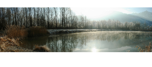
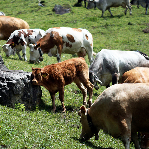
Pictures

Historical Weather
Related Locations
Information of geographic nature is based on public data provided by geonames.org, CIA world facts book, Unesco, DBpedia and wikipedia. Weather is based on NOAA GFS.