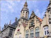
Explore Koksijde in Belgium
Koksijde in the region of Flanders with its 21,027 inhabitants is a town in Belgium - some 77 mi or ( 123 km ) West of Brussels , the country's capital city .
Current time in Koksijde is now 10:34 AM (Wednesday) . The local timezone is named " Europe/Brussels " with a UTC offset of 1 hours. Depending on the availability of means of transportation, these more prominent locations might be interesting for you: London, Haarlem, Amsterdam, Nieuwpoort, and Koksijde-Bad. Since you are here already, make sure to check out London . We saw some video on the web . Scroll down to see the most favourite one or select the video collection in the navigation. Where to go and what to see in Koksijde ? We have collected some references on our attractions page.
Videos
Apache AH64D + F16 Dutch Demo Team Looping + Flares Full HD Koksijde Air Show 2011
Apache AH64D + F16 Dutch Demo Team + Flares ..
Koksijde 2009 Teaser
Teaser for the upcoming Wheels-Up.be report on the Coxyde International Airshow 2009. If you like this video, join the Facebook Blue Foam fan group to keep up on news about future videos and get exclu ..
6 & 7 JUL 2001 BELGIUM KOKSIJDE CLIP AIRSHOW RAF-PARACHUTISTEN RAF - TORNADO SEAKING RS05
Korfilmpje van airshow te Koksijde Court-métrage Airshow à Koksijde (Coxyde) Belgique ..
Nicolas erklärt Flandern, Teil 19 - Pferdefischer in Oostduinkerke
Nicolas schaut den Pferdefischern bei der Arbeit zu. Mehr Informationen zu Flanderns Küste findet Ihr unter www.flandernskueste.de ..
Videos provided by Youtube are under the copyright of their owners.
Interesting facts about this location
Saint-Idesbald
Saint-Idesbald is a hamlet, part of Koksijde, which also includes Oostduinkerke. Its name refers to Idesbald, a 12th century abbot of the Abbey of Ten Duinen. In 1931, George Grard set up his studio at Saint-Idesbald, where his house became a rendezvous of artists including Pierre Caille, the Haesaerts brothers, Edgard Tytgat and Paul Delvaux. In 1982 the Paul Delvaux Museum opened in Saint-Idesbald.
Located at 51.11 2.61 (Lat./Long.); Less than 2 km away
Oostduinkerke
Oostduinkerke is a popular seaside resort in the Belgian province of West Flanders. The name Oostduinkerke translates as 'East Dunkirk'. The town originally shared its name with the French city of Dunkirk; therefore, in the 13th century, 'Oost-' was added to its name to avoid confusion with its French counterpart. Oostduinkerke is part of Koksijde, which also includes St-Idesbald and Wulpen. Oostduinkerke lies amidst a dune area (approximately 2.4 km²), which is now a protected nature reserve.
Located at 51.12 2.68 (Lat./Long.); Less than 3 km away
HMS Basilisk (H11)
HMS Basilisk was a B-class destroyer built for the Royal Navy around 1930. Initially assigned to the Mediterranean Fleet, she was transferred to the Home Fleet in 1936. The ship escorted convoys and conducted anti-submarine patrols early in World War II before participating in the Norwegian Campaign. Basilisk was sunk by German aircraft during the Dunkirk evacuation in 1940.
Located at 51.14 2.59 (Lat./Long.); Less than 4 km away
Plopsaland De Panne
Plopsaland De Panne is a theme park located near the town of De Panne on the Belgian coast. The park opened on 20 April 2000. Before that date (from 1936 to 1999) the park, created by a honey company, was called Meli-Park and had a bee theme.
Located at 51.08 2.60 (Lat./Long.); Less than 5 km away
Adinkerke
Adinkerke a small town in western Belgium close to the French border. It is a conurbation with the coastal town of De Panne which in turn is part of the west Belgian coastal conurbation. Adinkerke railway station is also the Western terminus of the Belgian coast tram line to De Panne; Nieuwpoort, Ostend and beyond. Near the city is Plopsaland. The 'kerke' suffix is common in west Flanders as an area surrounding a church. The closest French town is Ghyvelde and Bray dunes.
Located at 51.07 2.60 (Lat./Long.); Less than 6 km away
Pictures
Historical Weather
Related Locations
Information of geographic nature is based on public data provided by geonames.org, CIA world facts book, Unesco, DBpedia and wikipedia. Weather is based on NOAA GFS.


