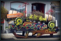
Discover Moere in Belgium
Moere in the region of Flanders is a town located in Belgium - some 63 mi or ( 102 km ) West of Brussels , the country's capital .
Local time in Moere is now 05:06 AM (Thursday) . The local timezone is named " Europe/Brussels " with a UTC offset of 1 hours. Depending on your flexibility, these larger cities might be interesting for you: London, Haarlem, Amsterdam, Torhout, and Ostend. When in this area, you might want to check out London . We found some clip posted online . Scroll down to see the most favourite one or select the video collection in the navigation. Are you looking for some initial hints on what might be interesting in Moere ? We have collected some references on our attractions page.
Videos
BLANKENBERGE FASHION MODELS.wmv
Photography Andre Cocquyt. www.dirtytreephotography.com ..
INDOOR Ichtegem
De Marnix die PLOTS een geniale inval had : "LATEN WE EENS ZIEN OF DE SPORTHAL BEZET IS " ;-) ..
Z563
Z563 being built at a belgian wharf Pls post any comments @ www.kotterfoto.nl ..
Ostende und Brügge Belgien 2005
Ostende und Brügge Belgien 2005 ..
Videos provided by Youtube are under the copyright of their owners.
Interesting facts about this location
Moere
Moere is a small village located within the municipality of Gistel in West-Flanders, Belgium. The village gained some fame when American singer Marvin Gaye moved there for several months in the early 1980s. During his stay, the singer composed his hit songs "Sexual Healing" and "Midnight Love. " The house he resided in remains an attraction to this day.
Located at 51.12 2.96 (Lat./Long.); Less than 0 km away
Eernegem
Eernegem is a town in Ichtegem, a part of Belgium. See also:
Located at 51.13 3.02 (Lat./Long.); Less than 4 km away
Leke
Leke is a town in Diksmuide, a part of Belgium in the province of West Flanders.
Located at 51.10 2.90 (Lat./Long.); Less than 5 km away
Vladslo German war cemetery
Vladslo German war cemetery is about three kilometres north east of Vladslo, near Diksmuide, Belgium. Established during World War I, the cemetery holds 3,233 wartime burials. In 1956, burials from many smaller surrounding cemeteries were concentrated in Vladslo, and it now contains the remains of 25,644 soldiers. Each stone bears the name of twenty soldiers, with just their name, rank, and date of death specified.
Located at 51.07 2.93 (Lat./Long.); Less than 6 km away
Keiem
Keiem is a small town situated some 7 km north of Diksmuide in West Flanders, Belgium. Administratively it forms part of Diksmuide Municipality. Lying close to the right bank of the River Yser, the town suffered extensive flooding when, on 21 October 1914, the sea locks at the mouth of this river were opened as a defensive measure against the advancing German army during the "Race to the Sea" phase of World War I.
Located at 51.08 2.88 (Lat./Long.); Less than 7 km away
Pictures
Historical Weather
Related Locations
Information of geographic nature is based on public data provided by geonames.org, CIA world facts book, Unesco, DBpedia and wikipedia. Weather is based on NOAA GFS.


