-
You are here:
- Homepage »
- Canada »
- British Columbia » Tofino

Tofino Destination Guide
Discover Tofino in Canada
Tofino in the region of British Columbia with its 1,655 habitants is a town located in Canada - some 2,324 mi or ( 3740 km ) West of Ottawa , the country's capital .
Local time in Tofino is now 03:47 AM (Tuesday) . The local timezone is named " America/Vancouver " with a UTC offset of -7 hours. Depending on your flexibility, these larger cities might be interesting for you: Portland, Seattle, Tacoma, Vancouver, and Victoria. When in this area, you might want to check out Portland . We found some clip posted online . Scroll down to see the most favourite one or select the video collection in the navigation. Are you looking for some initial hints on what might be interesting in Tofino ? We have collected some references on our attractions page.
Videos
Tofino & Long Beach, Vancouver Island, British Columbia, Canada
www.vridetv.com Tofino and long Beach British Columbia, Canada are featured in this weeks clip.VRIDETV (Description) Imagine mounting a high definition camcorder to the handlebars of a motorcycle then ..
Surfing the Pacific - Tofino, British Columbia
For any Canadian surfer who really enjoys catching waves and the chilled out vibe that goes along with the surf culture, then a trip to Tofino, on the west coast of Vancouver Island, is the ultimate p ..
16000 km - The Naked Truth
It was a sad day for the GCAT crew when we reached the beautiful little town of Tofino on the Pacific coast on the western edge of Canada. It meant that we had reached the end of an unforgettable trip ..
Oh Canada BMW R1200GSA
Canada coast to coast and back, 22855kms, 114 days, 6 time zones. Scott and Wanda aka the Bull and Goat travel on their BMW R1200GSA affectionately known as 'The Muskox' from Tofino British Columbia t ..
Videos provided by Youtube are under the copyright of their owners.
Interesting facts about this location
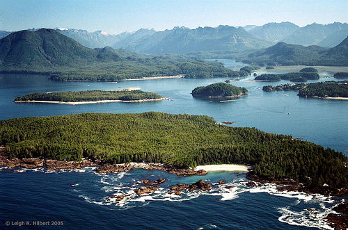
Tofino
Tofino is a district of about 1,876 residents on the west coast of Vancouver Island, in British Columbia, Canada, located at the western terminus of Highway 4, on the tip of the Esowista Peninsula, at the southern edge of Clayoquot Sound. The settlement of Tofino first acquired the name in 1909 with the opening of the Tofino Post Office, named in association with Tofino Inlet nearby.
Located at 49.14 -125.89 (Lat./Long.); Less than 1 km away
Opitsaht
Opitsaht, spelled also as Opitsat and Opitsitah, is a community of the Tla-o-qui-aht people of the Nuu-chah-nulth nation, located at the SW end of Meares Island in Clayoquot Sound. During the era of the Maritime Fur Trade, Opitsaht was the seat of Wickaninnish, chief of the Tla-o-qui-aht, and contained 200 ornately carved buildings typical of Nuu-chah-nulth villages.
Located at 49.17 -125.92 (Lat./Long.); Less than 2 km away
Meares Island
Meares Island is one of the many islands surrounding the Village of Tofino, British Columbia, Canada. Its name was given in 1862 by George Henry Richards, captain of HMS Hecate, in honor of John Meares. The island is located in the Clayoquot Sound region and is the location of Opitsat, the main village of the Tla-o-qui-aht First Nations, and was the location of Fort Defiance, a short-lived American fur-trading post founded by Captain Robert Gray.
Located at 49.17 -125.83 (Lat./Long.); Less than 5 km away
Lone Cone
Lone Cone is a mountain located 6 km north of Tofino and 7 km northwest of Mount Colnett on the western peninsula of Meares Island, British Columbia, Canada. The mountain has always been a noticeable landmark to all inhabitants with its looming presence on the north end of Meares Island. The early pioneers believed that if there were clouds blocking the summit then there would be approaching good weather. Lone Cone is composed of igneous rock of the Catface Intrusions.
Located at 49.21 -125.91 (Lat./Long.); Less than 6 km away
Fort Defiance (British Columbia)
Fort Defiance was a small outpost built by the crew of the Columbia Rediviva during the winter of 1791-1792. The crew under the command of American merchant and maritime fur trader Captain Robert Gray built the establishment on Meares Island in present day British Columbia, Canada.
Located at 49.21 -125.85 (Lat./Long.); Less than 7 km away
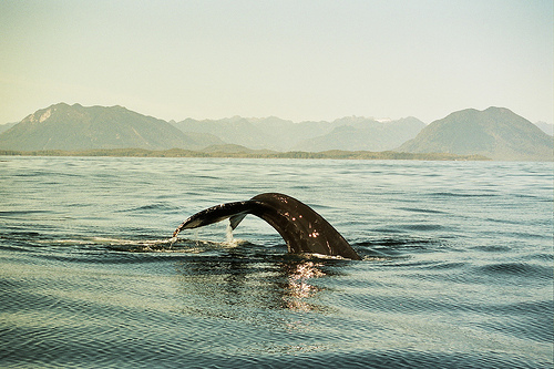
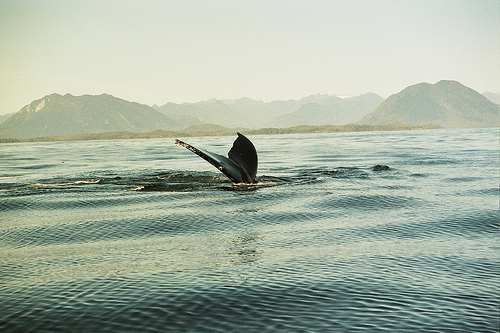
Pictures


Related Locations


Information of geographic nature is based on public data provided by geonames.org, CIA world facts book, Unesco, DBpedia and wikipedia. Weather is based on NOAA GFS.