
Explore Chateau-Richer in Canada
Chateau-Richer in the region of Quebec with its 3,563 inhabitants is a town in Canada - some 247 mi or ( 398 km ) North-East of Ottawa , the country's capital city .
Current time in Chateau-Richer is now 12:18 AM (Monday) . The local timezone is named " America/Montreal " with a UTC offset of -4 hours. Depending on the availability of means of transportation, these more prominent locations might be interesting for you: Augusta, Portland, Concord, Burlington, and Montpelier. Since you are here already, make sure to check out Augusta . We saw some video on the web . Scroll down to see the most favourite one or select the video collection in the navigation. Where to go and what to see in Chateau-Richer ? We have collected some references on our attractions page.
Videos
Club de Golf St-Laurent
Club de Golf St-Laurent Le plus beau défi de golf de la région de Québec ..
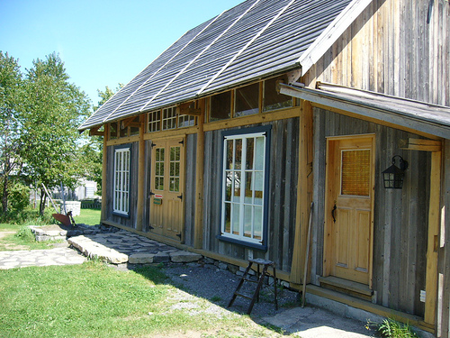
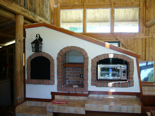
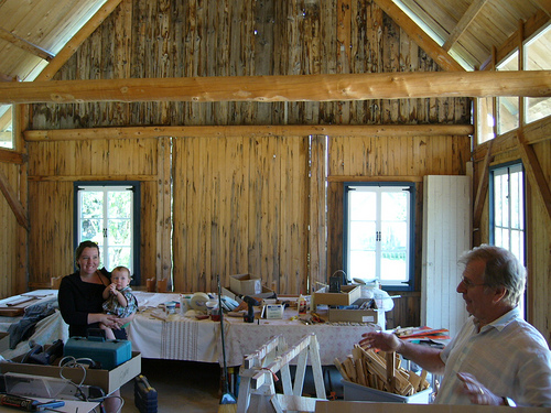
Gite la Maison du Mesnil/ Bed and Breakfast Quebec Ile d'Orleans
De style Manoir de la Nouvelle-France la Maison du Mesnil classe 4 soleils est un gite ( Bed and Breakfast ) situe sur le bord du fleuve St-Laurent a l'Ile d'Orleans dans un environnement historique. ..
Ile d'Orléans - été 2009
Petite virée à l'Île d'Orléans.... ..
Queen Mary II and Big Air
This my encounter with the Queen Mary II on the St-Laurence River seaway, near Quebec city. ..
Videos provided by Youtube are under the copyright of their owners.
Interesting facts about this location
Centre d'Interprétation de la Côte-de-Beaupré
The Centre d'Interprétation de la Côte-de-Beaupré (CICB), located in Château-Richer on the royal avenue, is renowned as centre of diffusion of La Côte-de-Beaupré by the M.R. C since 1996. It is also a part of the Route de la Nouvelle-France group, one of the oldest roads of Quebec.
Located at 46.97 -71.02 (Lat./Long.); Less than 1 km away
Île d'Orléans
Île d'Orléans (translated in English as Island of Orleans) is located in the Saint Lawrence River about 5 kilometres east of downtown Quebec City, Quebec, Canada. The island was one of the first parts of the province to be colonized by the French, and a large percentage of French Canadians can trace ancestry to early residents of the island. The island has been described as the "microcosm of traditional Quebec and as the birthplace of francophones in North America.
Located at 46.92 -70.98 (Lat./Long.); Less than 6 km away
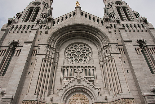
Basilica of Sainte-Anne-de-Beaupré
The Basilica of Sainte-Anne-de-Beaupré is a basilica set along the Saint Lawrence River in Quebec, Canada, 30 kilometres east of Quebec City. It has been credited by the Catholic Church with many miracles of curing the sick and disabled. It is an important Catholic sanctuary which receives about a half-million pilgrims each year, including the Anna Fusco Pilgrimage from Connecticut. The peak period of pilgrimage is around July 26, the feast of Saint Anne, the patron saint of Quebec.
Located at 47.02 -70.93 (Lat./Long.); Less than 11 km away
Montmorency Falls
The Montmorency Falls are a large waterfall on the Montmorency River in Quebec, Canada. The falls are located on the boundary between the borough of Beauport, Quebec City, and Boischatel, about 12 km from the heart of old Quebec City. The area surrounding the falls is protected within the Montmorency Falls Park (French: Parc de la Chute-Montmorency). The falls, at 84 meters (275 ft) high, (and 150 feet wide) are the highest in the province of Quebec and 30 m (98 ft) higher than Niagara Falls.
Located at 46.89 -71.15 (Lat./Long.); Less than 12 km away
Battle of Beauport
The Battle of Beauport, also known as the Battle of Montmorency, fought on 31 July 1759, was an important confrontation between the British and French Armed Forces during the Seven Years' War (also known as the French and Indian War and the War of Conquest) of the French province of Canada.
Located at 46.89 -71.15 (Lat./Long.); Less than 12 km away
Pictures


Related Locations


Information of geographic nature is based on public data provided by geonames.org, CIA world facts book, Unesco, DBpedia and wikipedia. Weather is based on NOAA GFS.