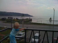
Explore La Malbaie in Canada
La Malbaie in the region of Quebec with its 8,959 inhabitants is a town in Canada - some 306 mi or ( 492 km ) North-East of Ottawa , the country's capital city .
Current time in La Malbaie is now 11:25 AM (Friday) . The local timezone is named " America/Montreal " with a UTC offset of -4 hours. Depending on the availability of means of transportation, these more prominent locations might be interesting for you: Augusta, Portland, Burlington, Montpelier, and Fredericton. Since you are here already, make sure to check out Augusta . We saw some video on the web . Scroll down to see the most favourite one or select the video collection in the navigation. Where to go and what to see in La Malbaie ? We have collected some references on our attractions page.
Videos
Canada - USA Voyage en famille 3
Voyage au Québec : Saint Ferréol les Neiges (parc des 7 chutes) , Charlevoix (Baie Saint Paul, Saint Joseph de la Rive, Saint Irénée, Hautes Gorges de la Malbaie), chutes Sagard, Saguenay. ..
T20111022-V2 Massif tourist train Clermont départ
Le train touristique du Massif de Charlevoix quitte son lieu d'entretien de Clermont pour aller prendre ses passagers à La Malbaie pour Québec, le 22 octobre 2011. Massif de Charlevoix new tourist tra ..
T20120310-1444 WB Massif Tourist Pointe-au-Pic
Le train touristique du Massif de Charlevoix passe sans arrêter la gare de Pointe-au-Pic, Québec, le 10 mars 2012. Massif Charlevoix tourist train pass at Pointe-au-Pic, Quebec, station without stoppi ..
QUEBEC (2^). QUEBEC CITY E LA REGIONE DI CHARLEVOIX
La Ville de Québec, o Quebec City, oltre ad essere la capitale dell'omonima provincia canadese è una delle città più affascinanti di tutto il Nord America e, con i suoi 400 anni di storia, vanta un pa ..
Videos provided by Youtube are under the copyright of their owners.
Interesting facts about this location
Charlevoix
The Charlevoix region, located in Quebec, includes parts of the north shore of the Saint Lawrence River and the Laurentian Mountains region of the Canadian Shield. This dramatic landscape includes rolling terrain, fjords, headlands and bays; the region was designated a World Biosphere Reserve by UNESCO in 1989.
Located at 47.65 -70.15 (Lat./Long.); Less than 1 km away
1663 Charlevoix earthquake
The 1663 Charlevoix earthquake occurred on February 5, 1663 in the Canadian province of Quebec, and was assessed to have a moment magnitude of between 7.3 and 7.9. The earthquake occurred at 5:30 p.m. local time and was estimated to have a maximum perceived intensity of X (Intense) on the Mercalli intensity scale.
Located at 47.60 -70.10 (Lat./Long.); Less than 8 km away
Charlevoix crater
The Charlevoix crater is a large eroded meteorite impact crater in the Charlevoix region of Quebec, Canada. Only part of the crater is exposed at the surface, the rest being covered by the Saint Lawrence River. The original crater is estimated to have been 54 kilometres in diameter and the age is estimated to be 342 ± 15 million years. The projectile was probably a stony asteroid, at least 2 kilometres in diameter, and weighing an estimated 15 billion tonnes .
Located at 47.53 -70.30 (Lat./Long.); Less than 18 km away
1997 Les Éboulements bus accident
The 1997 Les Éboulements bus accident, also known as the St. Joseph Bus Accident, occurred on Thanksgiving Day, October 13, 1997, in Les Éboulements (St-Joseph-de-la-Rive), Quebec, Canada. 44 died as a result of the accident, making it the deadliest road accident in Canadian history.
Located at 47.45 -70.33 (Lat./Long.); Less than 27 km away
Les Éboulements, Quebec
Les Éboulements is a municipality in the Capitale-Nationale region of Quebec, Canada. Its population centres include Les Éboulements (located along Route 362 on the plateau overlooking the Saint Lawrence River), Éboulements-Est (at the feet of Mount Éboulements), Cap-aux-Oies, Sainte-Marie-de-Charlevoix, and Saint-Joseph-de-la-Rive . Saint-Joseph-de-la-Rive, formerly known as Les Éboulements-en-Bas and Quai-des-Éboulements, is the departure point for ferries to L'Isle-aux-Coudres.
Located at 47.46 -70.37 (Lat./Long.); Less than 27 km away
Pictures
Related Locations
Information of geographic nature is based on public data provided by geonames.org, CIA world facts book, Unesco, DBpedia and wikipedia. Weather is based on NOAA GFS.


