
Explore Riom-es-Montagnes in France
Riom-es-Montagnes in the region of Auvergne with its 2,902 inhabitants is a place in France - some 247 mi or ( 398 km ) South of Paris , the country's capital city .
Time in Riom-es-Montagnes is now 05:30 PM (Wednesday) . The local timezone is named " Europe/Paris " with a UTC offset of 1 hours. Depending on your budget, these more prominent locations might be interesting for you: Trizac, Rodez, Pouzol, Paris, and Montboudif. Since you are here already, consider visiting Trizac . We saw some hobby film on the internet . Scroll down to see the most favourite one or select the video collection in the navigation. Where to go and what to see in Riom-es-Montagnes ? We have collected some references on our attractions page.
Videos
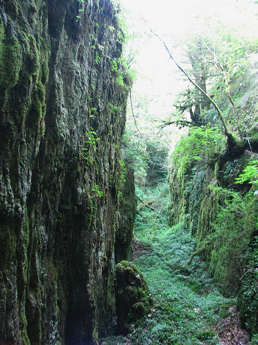
Gorges de la Jordanne (Cantal) France
Situées dans la vallée de Mandailles (Cantal) .Elles ont été creusées au fil des siècles dans des brèches volcaniques...Entre rocher, végétation et rivière, leur profondeur peut atteindre 60 mètres ! ..
rallye des gentianes.wmv
..
Concert de Cloches. Fête des cloches et sonnailles de Cheylade
Fête des cloches et sonnailles de Cheylade ..
Videos provided by Youtube are under the copyright of their owners.
Interesting facts about this location
Maronne
The Maronne is a 92.6 km long river in the Cantal and Corrèze départements, in south central France. Its source is several small streams joining near Récusset,a hamlet in Saint-Paul-de-Salers. It flows generally west. It is a left tributary of the Dordogne into which it flows between Argentat and Monceaux-sur-Dordogne.
Located at 45.14 2.60 (Lat./Long.); Less than 17 km away
Col d'Entremont
Col d'Entremont (el. 1,220 metres) is a mountain pass in the Massif Central located in Auvergne, France between the towns of Dienne and Murat in the Cantal department. It is located on the watershed between the basins of the River Loire and the River Dordogne.
Located at 45.15 2.82 (Lat./Long.); Less than 19 km away
Lac Chauvet
Lac Chauvet is a lake in Picherande, Puy-de-Dôme, France. At an elevation of 1176 m, its surface area is 0.54 km².
Located at 45.47 2.85 (Lat./Long.); Less than 25 km away
Rhue (river)
The Rhue (French: la Rhue, also called Grande Rhue) is a 56.6 km long river in the Puy-de-Dôme, Cantal and Corrèze départements, south central France. Its source is at Besse-et-Saint-Anastaise, near Super Besse, in the parc naturel régional des volcans d'Auvergne, 4.5 km southeast of the puy de Sancy. It flows generally southwest. It is a left tributary of the Dordogne into which it flows at Bort-les-Orgues. Its main tributaries are the Santoire, the petite Rhue and the Tarentaine.
Located at 45.50 2.85 (Lat./Long.); Less than 28 km away
Pictures
Historical Weather
Related Locations
Information of geographic nature is based on public data provided by geonames.org, CIA world facts book, Unesco, DBpedia and wikipedia. Weather is based on NOAA GFS.