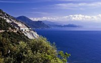
Explore Luri in France
Luri in the region of Corsica is a place in France - some 533 mi or ( 858 km ) South-East of Paris , the country's capital city .
Time in Luri is now 12:25 AM (Sunday) . The local timezone is named " Europe/Paris " with a UTC offset of 1 hours. Depending on your budget, these more prominent locations might be interesting for you: Sisco, Santa-Maria-di-Lota, Poggio, Piazza, and Nonza. Since you are here already, consider visiting Sisco . We saw some hobby film on the internet . Scroll down to see the most favourite one or select the video collection in the navigation. Where to go and what to see in Luri ? We have collected some references on our attractions page.
Videos
Nostalgia della Corsica
La nostalgia della Corsica in una serie di Cartoline d'epoca di Capo Corso. Autore: Danielle. Canzone: Nostalgia. Interprete: A.Ciosi test.isoladicapraia.it ..
Fabrication du fromage corse
Sur la route du fromage corse ..
Récupération du troupeau de chèvres en Corse
..
Corse Corsica (COS-2) cap Corse
Excursion autour du cap Corse visite des villages de Nonza, Luri, le port de pêche Centuri, Macinaggio, Morsiglia, Erbalunga. Marco Polo ou le voyage imaginaire www.marcopoloimaginaire.com ..
Videos provided by Youtube are under the copyright of their owners.
Interesting facts about this location
Torra di Seneca
The Torra di Seneca (French: Tour de Sénèque) is a Genoese tower in Corsica, located in the commune of Luri, Haute-Corse. It is one of the Official Historical Monuments of France since 1840.
Located at 42.90 9.37 (Lat./Long.); Less than 3 km away
Torra di Scalu
The Torra di Scalu is a tower in Corsica, located in the commune of Pino, Haute-Corse. It is one of the Official Historical Monuments of France.
Located at 42.91 9.34 (Lat./Long.); Less than 5 km away
Torra di Meria
The Torra di Meria is a Genoese tower in Corsica, located in the commune of Meria. It is one of the Official Historical Monuments of France.
Located at 42.93 9.47 (Lat./Long.); Less than 7 km away
Torra di Roglianu
The Torra di Roglianu is a Genoese tower in Corsica, located in the commune of Rogliano, Haute-Corse in the Cap Corse. It is one of the Official Historical Monuments of France since 1935. The tower was built in 1524 by Francesco de Negroni.
Located at 42.96 9.42 (Lat./Long.); Less than 7 km away
Cap Corse
Cap Corse, a geographical area of Corsica (Corse in French), is a 25-mile (40 km) long peninsula located at the northern tip of the island. At the base of it is the second largest city in Corsica, Bastia. Cap Corse is also a Communauté de communes comprising 18 communes.
Located at 42.83 9.42 (Lat./Long.); Less than 7 km away
Pictures
Historical Weather
Related Locations
Information of geographic nature is based on public data provided by geonames.org, CIA world facts book, Unesco, DBpedia and wikipedia. Weather is based on NOAA GFS.


