-
You are here:
- Homepage »
- France »
- Provence-Alpes-Cote d'Azur » Sainte-Maxime

Sainte-Maxime Destination Guide
Discover Sainte-Maxime in France
Sainte-Maxime in the region of Provence-Alpes-Côte d'Azur with its 13,582 habitants is a place located in France - some 435 mi or ( 699 km ) South-East of Paris , the country's capital .
Local time in Sainte-Maxime is now 08:04 PM (Sunday) . The local timezone is named " Europe/Paris " with a UTC offset of 1 hours. Depending on your mobility, these larger cities might be interesting for you: Toulon, Saint-Raphaël, Ramatuelle, Puget-sur-Argens, and Prat-Bourdin. When in this area, you might want to check out Toulon . We discovered some clip posted online . Scroll down to see the most favourite one or select the video collection in the navigation. Are you looking for some initial hints on what might be interesting in Sainte-Maxime ? We have collected some references on our attractions page.
Videos
ste maxime Var 83 France [frankrijk] Côte d'Azur
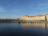
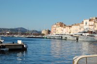
In the Gulf of Saint Tropez, Sainte Maxime faces straight south and is sheltered from the winds by the Maures Mountains. This exceptional site makes for an ideal vacation spot. The wonderful weather a ..
Côte d'Azur, Sainte-Maxime - Golfe de St-Tropez, Mimosenfest in Ste-Maxime
Côte d'Azur, Sainte-Maxime - Golfe de St-Tropez, Mimosenfest in Ste-Maxime Infos zu Frankreich - Côte d'Azur und Sainte-Maxime hier www.frankreich-cotedazur.de ..
Le Quai St Tropez June 2011
An evening in Le Quai St. Tropez June 2011 ..
Interview avec Armelle Barthalot
pascalecoumes.com ..
Videos provided by Youtube are under the copyright of their owners.
Interesting facts about this location
Ito-Balmond Serpentine Pavilion
The Ito-Balmond Serpentine Pavilion is a structure designed by Cecil Balmond and Toyo Ito and originally built for the Serpentine Gallery Pavilion programme in London’s Kensington Gardens, Hyde Park in 2002 and now part of a restaurant in southern France. It focuses on modern and contemporary art. Each year the Serpentine Gallery builds a temporary structure for the summer in its grounds and projects are led by director Julia Peyton-Jones.
Located at 43.29 6.61 (Lat./Long.); Less than 4 km away
Battle of Tourtour
The Battle of Tourtour of 973 was a great victory for the Christian forces of William I of Provence over the Andalusi pirates based at Fraxinetum.
Located at 43.32 6.47 (Lat./Long.); Less than 14 km away
Argens
The Argens is a 116 km long river of the French Riviera. Its basin is fully included in the Var department. The river goes through Vidauban, Le Muy, Roquebrune-sur-Argens, Fréjus, then it flows into the Mediterranean sea, near Fréjus.
Located at 43.41 6.74 (Lat./Long.); Less than 14 km away
Frejus Airport
Frejus Airport. is a former airport in France, located about 1 mile south of Saint-Raphaël (Departement du Var,Provence-Alpes-Côte d'Azur); 430 miles southeast of Paris. The airport today is closed, but appears to be well-maintained. Now it is used as a sport complex and contains facilities for, among others football, rugby, running, and basketball.
Located at 43.42 6.74 (Lat./Long.); Less than 14 km away
Gare de Fréjus
Gare de Fréjus is a railway station serving Fréjus, Var department, southeastern France. It is situated on the Marseille–Ventimiglia railway.
Located at 43.43 6.73 (Lat./Long.); Less than 16 km away
Pictures
Historical Weather
Related Locations
Information of geographic nature is based on public data provided by geonames.org, CIA world facts book, Unesco, DBpedia and wikipedia. Weather is based on NOAA GFS.

