-
You are here:
- Homepage »
- France »
- Rhone-Alpes » Saint-Pierre-de-Chartreuse

Saint-Pierre-de-Chartreuse Destination Guide
Touring Saint-Pierre-de-Chartreuse in France
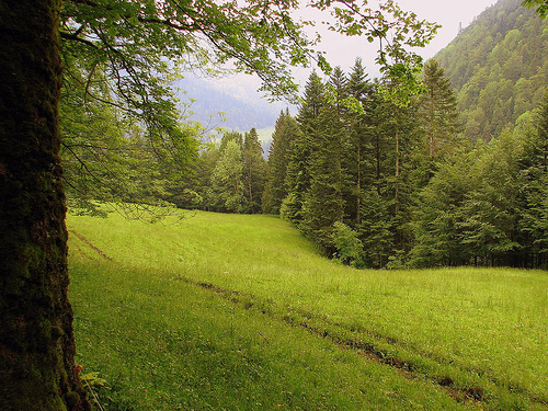
Saint-Pierre-de-Chartreuse in the region of Rhône-Alpes with its 865 citizens is a city located in France - some 292 mi or ( 470 km ) South-East of Paris , the country's capital city .
Time in Saint-Pierre-de-Chartreuse is now 05:02 AM (Monday) . The local timezone is named " Europe/Paris " with a UTC offset of 1 hours. Depending on your travel resources, these more prominent places might be interesting for you: Geneva, Valence, Saint-Pierre-de-Chartreuse, Saint-Ismier, and Saint Egreve. Being here already, consider visiting Geneva . We collected some hobby film on the internet . Scroll down to see the most favourite one or select the video collection in the navigation. Check out our recommendations for Saint-Pierre-de-Chartreuse ? We have collected some references on our attractions page.
Videos
Coupe icare 2010 : le crash ....
Pas de soucis le pilote est en vie, il a utilisé le parachute de l'avion (archeopterix). La suite se passe ici ; www.youtube.com ..
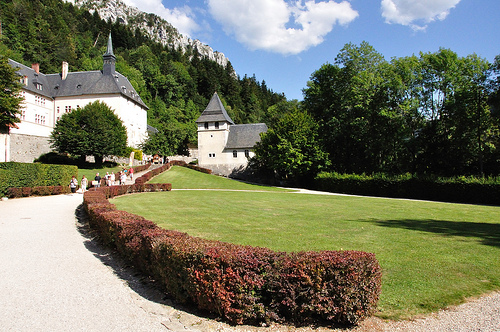
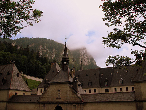
La Grande Chartreuse
The Grande Chartreuse is the headmonastery of the Carthusian order. Founded by St Bruno, the buildings today date back to 1676 when the monastery was rebuilt for the last time by Dom Le Masson. Mass i ..
Coupe Icare 2011, St-Hilaire du Touvet : le clip
Saint-Hilaire du Touvet, au cœur du parc naturel de Charteuse, a accueilli comme tous les ans depuis... 1974, la Coupe Icare. Les meilleurs "planeurs" mondiaux ont bien sûr répondu présent, offrant au ..
gonflage du ballon solaire
Le ballon solaire est un simple sac de plastique noir (très fin et léger) qui est rempli d'air. Le soleil réchauffera l'air dans le ballon et le fera s'envoler. ..
Videos provided by Youtube are under the copyright of their owners.
Interesting facts about this location
Chartreuse Mountains
The Chartreuse Mountains is a mountain range in southeastern France, stretching to the north from the city of Grenoble to the Lac du Bourget. It is the southernmost range in the Jura Mountains and belongs to the French Prealps. One of the larger cities in the Chartreuse Mountains is Voiron. The monastic Carthusian Order takes its name from these mountains, where its first hermitage was founded in 1084.
Located at 45.35 5.83 (Lat./Long.); Less than 2 km away
Grande Chartreuse
Grande Chartreuse is the head monastery of the Carthusian order. It is located in the Chartreuse Mountains, north of the city of Grenoble, in the commune of Saint-Pierre-de-Chartreuse, France. Originally, the château belonged to the See of Grenoble. In 1084, Saint Hugh gave it to hermit Saint Bruno and his followers who founded the Carthusian Order. Today, visitors are not permitted at Grand Chartreuse, and motor vehicles are prohibited on the surrounding roads.
Located at 45.36 5.79 (Lat./Long.); Less than 3 km away
Funiculaire de Saint-Hilaire du Touvet
|} The Funiculaire de Saint-Hilaire du Touvet, or Saint-Hilaire du Touvet Funicular, is a funicular railway in the département of Isère in the Rhône-Alpes region of France. It links Montfort on the road between Grenoble and Chambéry, with the village of Saint-Hilaire du Touvet, located on the Plateau des Petites Roches 600 metres above. Until the funicular was built, the village of St. Hilaire du Touvet was accessible only on foot, or by mule.
Located at 45.30 5.90 (Lat./Long.); Less than 8 km away
Dauphiné
The Dauphiné or Dauphiné Viennois is a former province in southeastern France, whose area roughly corresponded to that of the present departments of :Isère, :Drôme, and :Hautes-Alpes. The Dauphiné (also called Dauphiny in ancient English) was an independent state from 1040 to 1349, under the rule of the Counts of Albon, before joining the Kingdom of France. As a French province, it maintained its autonomy until 1457.
Located at 45.38 5.73 (Lat./Long.); Less than 8 km away
Club Cinq-Sept fire
The Club Cinq-Sept fire was a major disaster which took place in south-eastern France on Sunday, 1 November 1970. 146 people, almost all of them aged between 17 and 30, died when a nightclub just outside the small town of Saint-Laurent-du-Pont, Isère was completely destroyed in a catastrophic fire. The scale of the disaster shocked the French nation.
Located at 45.38 5.71 (Lat./Long.); Less than 9 km away
Pictures
Historical Weather
Related Locations
- Saint-Pierre-de-Cormeilles (Haute-Normandie)
- Saint-Pierre-de-Colombier (Rhône-Alpes)
- Saint-Pierre-de-Cole (Aquitaine)
- Saint-Pierre-de-Clairac (Aquitaine)
- Saint-Pierre-de-Chignac (Aquitaine)
- Saint-Pierre-de-Cheville (Pays de la Loire)
- Saint-Pierre-de-Cherennes (Rhône-Alpes)
- Saint-Pierre-de-Chemille (Pays de la Loire)
Information of geographic nature is based on public data provided by geonames.org, CIA world facts book, Unesco, DBpedia and wikipedia. Weather is based on NOAA GFS.