-
You are here:
- Homepage »
- France »
- Rhone-Alpes » Yvoire

Yvoire Destination Guide
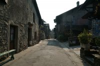
Discover Yvoire in France
Yvoire in the region of Rhône-Alpes with its 707 habitants is a town located in France - some 252 mi or ( 406 km ) South-East of Paris , the country's capital .
Local time in Yvoire is now 04:30 PM (Friday) . The local timezone is named " Europe/Paris " with a UTC offset of 1 hours. Depending on your flexibility, these larger cities might be interesting for you: Rolle, Nyon, Gland, Geneva, and Bursins. When in this area, you might want to check out Rolle . We found some clip posted online . Scroll down to see the most favourite one or select the video collection in the navigation. Are you looking for some initial hints on what might be interesting in Yvoire ? We have collected some references on our attractions page.
Videos
MacBook Air In Your Pocket - Ad (Parody)
www.inyourpocket.com Unboxing of an In Your Pocket guide which is one of the thinnest city guides in the world. In Your Pocket guides are thinner and more compact than the MacBook Air, they are wirele ..
Appartements Nernier
Appartements à vendre à Nernier (Haute-Savoie), Lac Léman. ..
Je viens d'un Pays_Gérard Aubert
Je vous présente mon pays la Suisse. ..
Les Peintures de Robert Duncan
De magnifiques peintures de Robert Duncan sur la campagne avec une jolie musique de Ricky King. ..
Videos provided by Youtube are under the copyright of their owners.
Interesting facts about this location
Toblerone line
The Toblerone line is a 10-km long defensive line made of dragon's teeth that was built during the second World War between Bassins and Prangins, in the Canton of Vaud, Switzerland. These lines of defensive blocks can be found all over Switzerland, but more predominantly in border areas. Their purpose was to stop tank invasions. The 2,700 9-ton concrete blocks that make up the defences are similar to the shape of the chocolate bar "Toblerone", which gave its name to the line.
Located at 46.40 6.28 (Lat./Long.); Less than 5 km away
Prangins Castle
Prangins Castle is a castle in the municipality of Prangins of the Canton of Vaud in Switzerland. It is a Swiss heritage site of national significance.
Located at 46.39 6.25 (Lat./Long.); Less than 6 km away
La Côte Airport
The La Côte Airport is a private airport in Prangins, Switzerland. It hosted a fly-in in 2009
Located at 46.41 6.26 (Lat./Long.); Less than 7 km away
Nyon Castle
Nyon Castle is a castle in the municipality of Nyon of the Canton of Vaud in Switzerland. It is a Swiss heritage site of national significance.
Located at 46.38 6.24 (Lat./Long.); Less than 7 km away
Dully Castle
Dully Castle is a castle in the municipality of Dully of the Canton of Vaud in Switzerland. It is a Swiss heritage site of national significance.
Located at 46.43 6.29 (Lat./Long.); Less than 7 km away
Pictures
Historical Weather
Related Locations
Information of geographic nature is based on public data provided by geonames.org, CIA world facts book, Unesco, DBpedia and wikipedia. Weather is based on NOAA GFS.

