
Discover Struppen in Germany
Struppen in the region of Saxony with its 2,749 habitants is a town located in Germany - some 113 mi or ( 182 km ) South of Berlin , the country's capital .
Local time in Struppen is now 04:25 PM (Tuesday) . The local timezone is named " Europe/Berlin " with a UTC offset of 1 hours. Depending on your flexibility, these larger cities might be interesting for you: Zeichen, Struppen-Siedlung, Struppen, Stolpen, and Naundorf. When in this area, you might want to check out Zeichen . We found some clip posted online . Scroll down to see the most favourite one or select the video collection in the navigation. Are you looking for some initial hints on what might be interesting in Struppen ? We have collected some references on our attractions page.
Videos
Small Life in Saxon Switzerland Zeitraffer Tilt Shift Time Lapse
New Version on Vimeo: vimeo.com I shot this scenes in the Saxon Switzerland. This is a National Park in the east of Germany along the river Elbe. In this clip you can see the Fortress Königstein, the ..
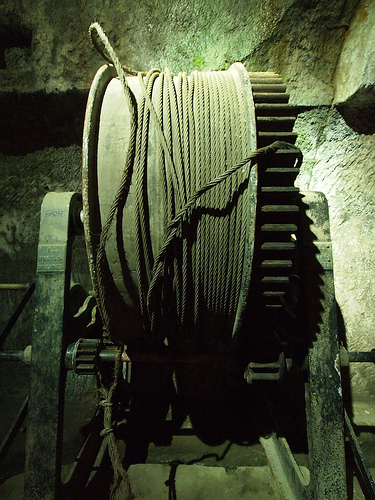
Fortress Konigstein
Fortress Konigstein. June 2007 ..
The Bastei
The Bastei in Saxony Germany ..
Historisch-romantischer Weihnachtsmarkt auf der Festung Königstein
Wenn die kalte Nordwinde und die Schneekönigin um die Festungsmauern streichen ist die richtige Zeit für Festungspunsch und Leckereien auf unserem historisch-romantischen Weihnachtsmarkt. Musik- und M ..
Videos provided by Youtube are under the copyright of their owners.
Interesting facts about this location
Bärensteine
The Bärensteine is a massif in the state of Saxony in eastern Germany near Weißig. It comprises the two rock formations known as the Großer and Kleiner Bärenstein (the "Great" and "Little Bear Rock") in Saxon Switzerland. The Kleiner Bärenstein has a height of 338 metres . The more prominent Großer Bärenstein is actually the lower of the two with a height of 327 metres . On the Kleiner Bärenstein there used to be a panorama restaurant that belonged to the manor house at Thürmsdorf.
Located at 50.95 14.04 (Lat./Long.); Less than 2 km away
Krietzschwitz
Krietzschwitz is a subdivision of Pirna, in the Free State of Saxony, Germany. It was incorporated into Pirna in 1922. The place was mentioned for the first time in 1359. The name originates from the Slavic language. Krietzschwitz has a farmer's market. It has access to route 172.
Located at 50.93 13.98 (Lat./Long.); Less than 3 km away
Niedervogelgesang
Niedervogelgesang, a settlement in Germany, has been part of the city of Pirna since 1922. It was founded in the 16th century in the form of a Vorwerk on the left bank of the Elbe river. Its name translates as "Lower-Birdsinging."
Located at 50.95 13.98 (Lat./Long.); Less than 3 km away
Neundorf (Pirna)
Neundorf' is a subdivision of Pirna, Germany. It was incorporated into Pirna in 1922. It was mentioned in 1408.
Located at 50.92 13.98 (Lat./Long.); Less than 3 km away
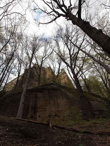
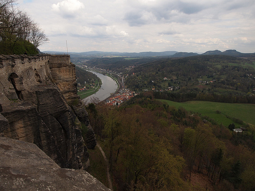
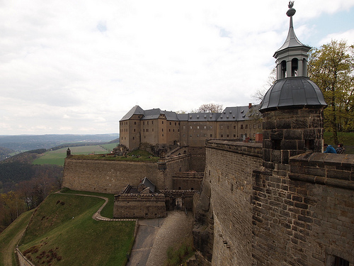
Königstein Fortress
Königstein Fortress, the "Saxon Bastille", is a hilltop fortress near Dresden, in Saxon Switzerland, Germany, above the town of Königstein on the left bank of the River Elbe. It is one of the largest hilltop fortifications in Europe and sits atop the table hill of the same name. The 9.5 hectare rock plateau rises 240 metres above the Elbe and has over 50 buildings, some over 400 years old, that bear witness to the military and civilian life in the fortress.
Located at 50.92 14.06 (Lat./Long.); Less than 3 km away
Pictures
Historical Weather
Related Locations
Information of geographic nature is based on public data provided by geonames.org, CIA world facts book, Unesco, DBpedia and wikipedia. Weather is based on NOAA GFS.