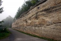
Touring Rothenstein in Germany
Rothenstein in the region of Thuringia with its 1,432 citizens is located in Germany - some 139 mi or ( 224 km ) South-West of Berlin , the country's capital city .
Time in Rothenstein is now 06:16 PM (Sunday) . The local timezone is named " Europe/Berlin " with a UTC offset of 1 hours. Depending on your budget, these more prominent places might be interesting for you: Weira, Unterbodnitz, Trockenborn-Wolfersdorf, Schops, and Rothenstein. Being here already, consider visiting Weira . We collected some hobby film on the internet . Scroll down to see the most favourite one or select the video collection in the navigation. Check out our recommendations for Rothenstein ? We have collected some references on our attractions page.
Videos
Leuchtenburg - Königin des Saaletals
Leuchtenburg bei Kahla. Eine der schönsten Burgen Thüringens. ..
Amokdrang - Moscato
Livevideo vom 09.05.2009 zu Moscato von Amokdrang Check out www.amokdrang.de Download the live album for free at http oder at rapidshare.com Download the video for free (Xvid 1000kbps) at rapidshare.c ..
Neujahrswanderung 2011 Dohlenstein & Leuchtenburg bei Kahla Thüringen Winterimpressionen
Neujahrswanderung 2011 Dohlenstein & Leuchtenburg bei Kahla Thüringen Winterimpressionen ..
Am Morgen auf der Leuchtenburg bei Kahla / Thüringen im Saaletal 18.10.2010
Am Morgen auf der Leuchtenburg bei Kahla / Thüringen im Saaletal 18.10.2010 ..
Videos provided by Youtube are under the copyright of their owners.
Interesting facts about this location
Südliches Saaletal
Südliches Saaletal is a Verwaltungsgemeinschaft ("collective municipality") in the district Saale-Holzland, in Thuringia, Germany. The seat of the Verwaltungsgemeinschaft is in Kahla, itself not part of the Verwaltungsgemeinschaft. The Verwaltungsgemeinschaft Südliches Saaletal consists of the following municipalities:
Located at 50.80 11.58 (Lat./Long.); Less than 6 km away
IPHT Jena
The Institute of Photonic Technology is a non-university research facility in Jena, Thuringia, Germany. Focused on applications for various physical systems, the Institute's mandate is to find solutions to challenges in high technology systems. IPHT carries out research in the following areas: magnetics, quantum electronics, optics, microsystems, biophotonics and laser technology. The Institute works with both universities and companies.
Located at 50.91 11.57 (Lat./Long.); Less than 7 km away
Max Planck Institute for Chemical Ecology
The Max Planck Institute for Chemical Ecology is located on Beutenberg campus in Jena, Germany. It was founded in March 1996 and is one of 80 institutes of the Max Planck Society (Max Planck Gesellschaft). Chemical ecology examines the role of chemical signals that mediate the interactions between plants, animals, and their environment, as well as the evolutionary and behavioral consequences of these interactions.
Located at 50.91 11.57 (Lat./Long.); Less than 7 km away
Max Planck Institute for Biogeochemistry
The Max Planck Institute for Biogeochemistry is located in Jena, Germany. It was created in 1997, and moved into new buildings 2002. It is one of 80 institute in the Max Planck Society (Max Planck Gesellschaft). {{#invoke:Coordinates|coord}}{{#coordinates:50|54|38|N|11|34|2|E|type:landmark |primary |name= }}
Located at 50.91 11.57 (Lat./Long.); Less than 7 km away
Ernst-Abbe-Sportfeld
The Ernst-Abbe-Sportfeld is a sports facility in Jena, Germany. It was dedicated on August 24, 1924 and was named after entrepreneur Ernst Abbe 15 years later. The facility is in southern Jena, directly on the Saale River. The City of Jena purchased the stadium from the Ernst-Abbe-Stiftung (The Ernst Abbe Foundation) in 1991. The soccer and track stadium in the Ernst-Abbe-Sportfeld is the home field of FC Carl Zeiss Jena and TuS Jena. It has a capacity of over 12,990.
Located at 50.92 11.58 (Lat./Long.); Less than 7 km away
Pictures
Historical Weather
Related Locations
Information of geographic nature is based on public data provided by geonames.org, CIA world facts book, Unesco, DBpedia and wikipedia. Weather is based on NOAA GFS.


