-
You are here:
- Homepage »
- Greece »
- Central Greece » Ayios Thomas

Ayios Thomas Destination Guide
Delve into Ayios Thomas in Greece
Ayios Thomas in the region of Central Greece with its 1,433 residents is a city in Greece - some 22 mi or ( 35 km ) North of Athens , the country's capital .
Current time in Ayios Thomas is now 03:41 AM (Thursday) . The local timezone is named " Europe/Athens " with a UTC offset of 2 hours. Depending on your travel modalities, these larger destinations might be interesting for you: Vathi, Vasilikon, Stefani, Lacedaemon, and Pili. While being here, make sure to check out Vathi . We encountered some video on the web . Scroll down to see the most favourite one or select the video collection in the navigation. Are you curious about the possible sightseeing spots and facts in Ayios Thomas ? We have collected some references on our attractions page.
Videos
Grecia 2008 plaza syntagma en Atenas. Evzones III
31 de agosto.En la plaza sybtagma se encuentra el parlamento o Vouli. Frente a él el monumento al soldado desconocido. Hay una guardia permanente "Evzones" que viste un traje tradicional. Los domingos ..
Enduro training day - @Varibobi
www.dirtbike.gr ..
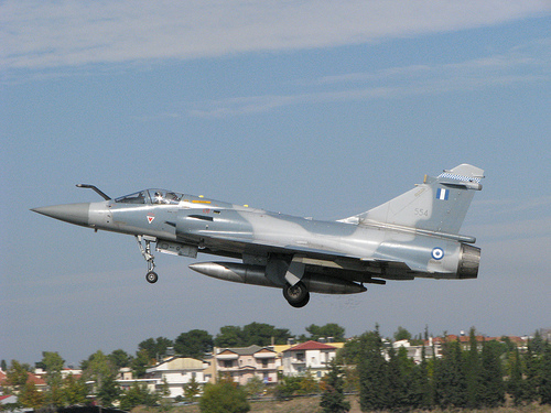
Frecce Tricolori at Tanagra AFB
The famous aerobatics team at Archangelos 2005 air show ..
Train-spotting at Inofita Greece (04/03/12)
Inofita station,central Greece. Inofita is a small town (pop.3697) located in the southeastern portion of the prefecture of Viotia north of Athens. German built by ADtranz/BOMBARDIER diesel-electric l ..
Videos provided by Youtube are under the copyright of their owners.
Interesting facts about this location
Battle of Oenophyta
The Battle of Oenophyta took place between Athens and the Boeotian city-states in 457 BC during the First Peloponnesian War. In this period between the Persian Wars and the Peloponnesian War, alliances and leagues sprang up and collapsed, although there was very little prolonged warfare.
Located at 38.30 23.63 (Lat./Long.); Less than 4 km away
Lefkandi
Lefkandi is a coastal village on the island of Euboea. Archaeological finds attest to a settlement on the promontory locally known as Xeropolis, while several associated cemeteries have been identified nearby. The settlement site is located on a promontory overlooking the Euripos, with small bays forming natural harbours east and west of the site.
Located at 38.41 23.68 (Lat./Long.); Less than 16 km away
Parnitha
Mount Parnitha is a densely forested mountain range north of Athens, the highest on the peninsula of Attica, with an elevation of 1,413 m, and a summit known as Karavola (Καραβόλα). Much of the mountain is designated a national park, and is a protected habitat for wildfowl, first created in 1961. The summit is located 18 km N of Acharnae and about 30 km N of Athens, while the mountain covers approximately 250 km² of land.
Located at 38.17 23.72 (Lat./Long.); Less than 16 km away
1999 Athens earthquake
The 1999 Athens earthquake, registering a moment magnitude of 6.0, occurred on September 7, 1999, at 2:56:50 pm local time and lasted approximately 15 seconds in Ano Liosia. The tremor was epicentered approximately 17 km to the northwest of the city center, in a sparsely populated area between the working-class town of Acharnes and the Mount Parnitha National Park.
Located at 38.11 23.60 (Lat./Long.); Less than 19 km away
Parnitha Funitel
The Parnitha Funitel on Mont Parness is the successor of an aerial tramway constructed in the 1970s to serve Casino Mont Parnes, the most popular casino in the Athens area, located on one of the peaks of mount Parnitha. Also, it was a common way for Athenians to reach on the peak for family day trips, a popular habit even today. However, since April 2006, a newly-built funitel, replacing the older one, was launched and it continues serving its previous purposes.
Located at 38.14 23.74 (Lat./Long.); Less than 20 km away
Pictures
Historical Weather
Related Locations
Information of geographic nature is based on public data provided by geonames.org, CIA world facts book, Unesco, DBpedia and wikipedia. Weather is based on NOAA GFS.