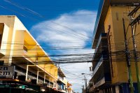
Touring La Ceiba in Honduras
La Ceiba in the region of Atlántida with its 130,218 citizens is located in Honduras - some 119 mi or ( 192 km ) North of Tegucigalpa , the country's capital city .
Time in La Ceiba is now 03:54 PM (Monday) . The local timezone is named " America/Tegucigalpa " with a UTC offset of -6 hours. Depending on your budget, these more prominent places might be interesting for you: Dangriga, Belmopan, Belize City, San Salvador, and Santa Tecla. Being here already, consider visiting Dangriga . We collected some hobby film on the internet . Scroll down to see the most favourite one or select the video collection in the navigation. Check out our recommendations for La Ceiba ? We have collected some references on our attractions page.
Videos
Carnival 2009 - Carnaval de La Ceiba, Honduras
Carnival is an annual celebration in La Ceiba, Honduras held on the 4th Saturday of May. It is the largest carnival in Central America. The week leading up to the final day is marked with competitions ..
Tour of La Ceiba, Honduras
La Ceiba is a port city on the northern coast of Honduras in Central America. It is located on the southern edge of the Caribbean Sea. With a population of over 200000 living in approximately 170 resi ..
Foundation 4Life in Honduras - Day 2, 2011
foundation4life.org - Foundation 4Life® Director Tracie Kay and Senior VP of Marketing, Trent Tenney continue to deliver backpacks assembled at BIG Convention 2010 and 4Life Fortify® meals, provided b ..
Tropical Storm La Ceiba Part II
Tropical storm in La Ceiba, Honduras, 11 December 2008. We received 12 inches of rain in one day and it is still raining! ..
Videos provided by Youtube are under the copyright of their owners.
Interesting facts about this location
Estadio Nilmo Edwards
Estadio Ceibeño is a multi-purpose stadium in La Ceiba, Honduras. It is currently used mostly for football matches and is the home stadium of Victoria and Vida. The stadium holds 18,000 people. It has been used for music concerts on occasion.
Located at 15.79 -86.79 (Lat./Long.); Less than 3 km away
Mazapan School
Mazapan School is a small PK-12 co-educational bilingual school offering a US-style college preparatory instruction program. Owned and operated by Standard Fruit de Honduras (Dole), Mazapan School is located in La Ceiba, Honduras. Founded in 1928, the landscaped campus is located on 5 acres in a quiet, peaceful, and secured subdivision near the center of the city, amidst lush, tropical vegetation. The 300+ students attending Mazapan School are taught in English and Spanish, and receive a U.S.
Located at 15.78 -86.79 (Lat./Long.); Less than 3 km away
La Ceiba
La Ceiba is a port city on the northern coast of Honduras in Central America. It is located on the southern edge of the Caribbean, forming part of the south eastern boundary of the Gulf of Honduras. With an estimated population of over 170,000 living in approximately 170 residential areas (called colonias or barrios), it is the fourth largest city in the country and the capital of the Honduran department of Atlántida. La Ceiba was officially founded on August 23, 1877.
Located at 15.77 -86.83 (Lat./Long.); Less than 6 km away
Armenia Bonito, Atlántida
Armenia Bonito - A "barrio" or "colonia" 7 miles west of downtown La Ceiba in the Atlántida Department in the country of Honduras in Central America. It is located in the northern part of Honduras within view of Caribbean Sea.
Located at 15.73 -86.86 (Lat./Long.); Less than 9 km away
Sambo Creek
Sambo Creek is a traditional Garífuna village 15 kilometres east of La Ceiba on the Caribbean Sea north coast of Honduras. An annual fair is held in June. Sambo Creek has the largest Garifuna population in Honduras and is considered to be a true Garifuna town. Sambo Creek is the best place to find traditional punta dances every Sunday by the beach. Ethnic Mix: 65% Garifuna, 35% Mestizo Among the famous natives are Olympic sprinter Rolando Palacios.
Located at 15.82 -86.68 (Lat./Long.); Less than 12 km away
Pictures
Related Locations
Information of geographic nature is based on public data provided by geonames.org, CIA world facts book, Unesco, DBpedia and wikipedia. Weather is based on NOAA GFS.


