
Explore Kannur in India
Kannur in the region of Kerala with its 62,836 inhabitants is a place in India - some 1,165 mi or ( 1874 km ) South of New Delhi , the country's capital city .
Time in Kannur is now 08:59 AM (Sunday) . The local timezone is named " Asia/Kolkata " with a UTC offset of 5.5 hours. Depending on your budget, these more prominent locations might be interesting for you: Thiruvananthapuram, Thrissur, Thalassery, Pappinisseri, and Panjim. Since you are here already, consider visiting Thiruvananthapuram . We saw some hobby film on the internet . Scroll down to see the most favourite one or select the video collection in the navigation. Where to go and what to see in Kannur ? We have collected some references on our attractions page.
Videos
HAMID YASEEN AL JOUHARI KOLLAM at kannur city . rushdicity@gmail.com @ 9995256729
..
kannur old busstand to new bustand in a rikshaw.
Place: Kannur. (kerala, India). A perfect tourist place with good cafes and hotels and people. Kannur is the God's home in God's own country(kerala). ..
An Interview with Sabith....
Thenalliraman interviewing sabi.... :) ..
Ganesh visarjan procession. Part of Sarvajanik Ganesh Utsav 2012 - Kannur, Kerala.
Sarvajanik Ganesh Utsav 2012 - Kannur, Kerala. Glimpses of traditional Maratha Dhol - "Shivagarjana" as it is popularly known as, from bands coming from as far as Nasik in Maharashtra to various parts ..
Videos provided by Youtube are under the copyright of their owners.
Interesting facts about this location
Kannur railway station
Kannur, also known as Cannanore, is one of the busiest railway station in Kerala located in the Kannur City. It is operated by the Southern Railway of the Indian Railways. There are many trains operating towards Southern Kerala, Tamil Nadu, Mumbai and North India. Kannur and Kannur South are two different stations which serves the Kannur District. This Station has four platforms and two entrances. Another platform and new exclusive entrance is under construction towards east.
Located at 11.87 75.36 (Lat./Long.); Less than 0 km away
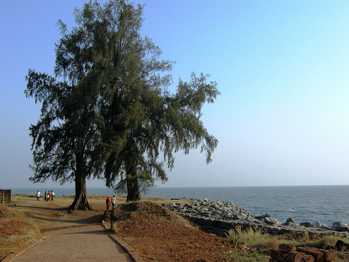
Payyambalam Beach
Payyambalam Beach is a beach in Kannur district of Kerala in India that attracts tourists and local people. It often finds mention in tourism related publications as a beautiful beach. It has now a garden close to it. The beach is just 2 km from Kannur town.
Located at 11.87 75.35 (Lat./Long.); Less than 1 km away
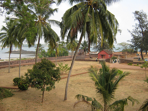
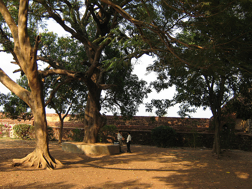
St. Angelo Fort
St. Angelo Fort (also known as Kannur Fort or Kannur Kotta), is a fort facing the Arabian Sea, situated 3 km from the town of Kannur, a city in Kerala state, south India.
Located at 11.85 75.37 (Lat./Long.); Less than 2 km away
Mappila Bay
Mappila Bay (or Moppila Bay) is a natural harbor situated in Ayikkara Kannur town, Kerala state of South India. On one side of the bay is Fort St. Angelo, built by the Portuguese in the 15th century and the other side is the Arakkal Palace. The bay was famous during the Kolathiri's regime as a commercial harbour that linked Kolathunadu with Lakshadweep and foreign countries, in imports.
Located at 11.86 75.38 (Lat./Long.); Less than 2 km away
Pallikunnu
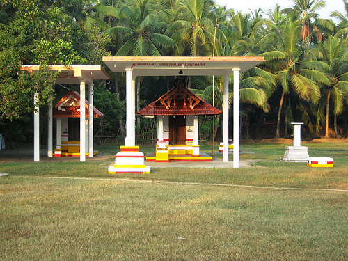
Pallikkunnu is a small township in Kannur, Kerala state, in South India. It is located outside the Kannur Town municipal limits, on the National Highway between Kannur and Payyannur. It is three kilometers away from Kannur Town. Pallikunnu houses several educational institutions, including Sreepuram English Medium School, the Krishna Menon Memorial Government Women's College, and the Kerala Vocational Training Center. Pallikunnu is famous for the Mookambika Temple.
Located at 11.89 75.37 (Lat./Long.); Less than 3 km away
Pictures


Historical Weather
Related Locations
Information of geographic nature is based on public data provided by geonames.org, CIA world facts book, Unesco, DBpedia and wikipedia. Weather is based on NOAA GFS.