Discover Valapattanam in India
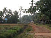
Valapattanam in the region of Kerala with its 8,117 habitants is a town located in India - some 1,162 mi or ( 1871 km ) South of New Delhi , the country's capital .
Local time in Valapattanam is now 01:43 PM (Tuesday) . The local timezone is named " Asia/Kolkata " with a UTC offset of 5.5 hours. Depending on your flexibility, these larger cities might be interesting for you: Thiruvananthapuram, Thrissur, Thalassery, Taliparamba, and Panjim. When in this area, you might want to check out Thiruvananthapuram . We found some clip posted online . Scroll down to see the most favourite one or select the video collection in the navigation. Are you looking for some initial hints on what might be interesting in Valapattanam ? We have collected some references on our attractions page.
Videos
HAMID YASEEN AL JOUHARI KOLLAM at kannur city . rushdicity@gmail.com @ 9995256729
..
Ganesh visarjan procession. Part of Sarvajanik Ganesh Utsav 2012 - Kannur, Kerala.
Sarvajanik Ganesh Utsav 2012 - Kannur, Kerala. Glimpses of traditional Maratha Dhol - "Shivagarjana" as it is popularly known as, from bands coming from as far as Nasik in Maharashtra to various parts ..
DIEGO MARADONA IN KANNUR
BY, DHANYAM CREATIONS, ANJARAKANDY KERALA, ranjini hari das dancing with maradona , Im vijayan with his hero maradona. GODS OWN COUNTRY WELCOMES DEIGO MARADONA. Football great Diego Maradona arrived t ..
Kerala's Largest Theyyam - 2011
'Kettiyaatal' of largest 'Theyyakkolam' of Kerala at Maaniyoor Kizhakkan Bhagavathi temple (in Kannur district).Thiruvananthapuram Doordarshan's news visuals,telecast on 27 May 2011Friday. ..
Videos provided by Youtube are under the copyright of their owners.
Interesting facts about this location
Valapattanam
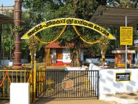
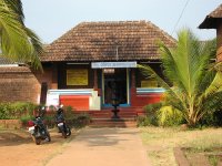
Valapattanam is a small town in the Kannur district, located in the Indian state of Kerala. It is also the smallest panchayath in kerala. Its area is 2.04 sqr Km. It is about 7 km north of Kannur. Valapattanam is an important Muslim settlement area in Kannur. Valapattanam is known for its communal harmony. On one hand one can see the "Kalarivathukkal temple" and on the other hand you have the "Kakkulangara Mosque" lying in close proximity.
Located at 11.90 75.37 (Lat./Long.); Less than 0 km away
Pallikunnu
Pallikkunnu is a small township in Kannur, Kerala state, in South India. It is located outside the Kannur Town municipal limits, on the National Highway between Kannur and Payyannur. It is three kilometers away from Kannur Town. Pallikunnu houses several educational institutions, including Sreepuram English Medium School, the Krishna Menon Memorial Government Women's College, and the Kerala Vocational Training Center. Pallikunnu is famous for the Mookambika Temple.
Located at 11.89 75.37 (Lat./Long.); Less than 1 km away
Cannanore lighthouse
The Cannanore lighthouse is located near the Payyambalam Beach, a few kilometers from Kannur town, in Kerala state, south India. It is adjacent to the Sea View Park and the Government Guest House. The lighthouse is still active and overlooks the Arabian Sea. Cannanore is the old English name for the town named Kannur. The lighthouse at Kannur is still often referred to as the Cannanore lighthouse.
Located at 11.90 75.40 (Lat./Long.); Less than 4 km away
Payyambalam Beach
Payyambalam Beach is a beach in Kannur district of Kerala in India that attracts tourists and local people. It often finds mention in tourism related publications as a beautiful beach. It has now a garden close to it. The beach is just 2 km from Kannur town.
Located at 11.87 75.35 (Lat./Long.); Less than 4 km away
Mappila Bay
Mappila Bay (or Moppila Bay) is a natural harbor situated in Ayikkara Kannur town, Kerala state of South India. On one side of the bay is Fort St. Angelo, built by the Portuguese in the 15th century and the other side is the Arakkal Palace. The bay was famous during the Kolathiri's regime as a commercial harbour that linked Kolathunadu with Lakshadweep and foreign countries, in imports.
Located at 11.86 75.38 (Lat./Long.); Less than 5 km away
Pictures
Historical Weather
Related Locations
Information of geographic nature is based on public data provided by geonames.org, CIA world facts book, Unesco, DBpedia and wikipedia. Weather is based on NOAA GFS.


