-
You are here:
- Homepage »
- India »
- Uttar Pradesh » Jhusi

Jhusi Destination Guide
Touring Jhusi in India
Jhusi in the region of Uttar Pradesh with its 16,642 citizens is a city located in India - some 365 mi or ( 587 km ) South-East of New Delhi , the country's capital city .
Time in Jhusi is now 03:38 AM (Friday) . The local timezone is named " Asia/Kolkata " with a UTC offset of 5.5 hours. Depending on your travel resources, these more prominent places might be interesting for you: Subedarganj, Sirsa, Sikandra, Ranchi, and Phaphamau. Being here already, consider visiting Subedarganj . We collected some hobby film on the internet . Scroll down to see the most favourite one or select the video collection in the navigation. Check out our recommendations for Jhusi ? We have collected some references on our attractions page.
Videos
Kumbh Mela Allahabad
Allahabad and the Kumbh Mela that is held here is considered to be the largest and holiest of all the four destinations and is believed to be the most auspicious. Allahabad is one of the most sacred c ..
INDIAN RAILWAYS:Crossing Yamuna River and Kalka Mail led by WAP7 30230 on Sangam Bridge
The Sangam bridge is a confluence of 3 rivers at Prayag (Allahabad, UP State). Here, my Chambal Express is crossing the Kalka Mail on the Yamuna River bridge at Prayag, ..
Omaxe Water Front Hi-Tech City - Naini, Allahabad
Visit: www.propertywala.com Omaxe Water Front Hi-Tech City - Naini, Allahabad - Self-Sustained Township The Water front Hi- tech Township project by Omaxe is conceived under the grand vision, under Hi ..
Omaxe Naffhil Homes - Naini, Allahabad
Visit: www.propertywala.com Omaxe Naffhil Homes - Naini, Allahabad - Residential Apartments To be built over an area of approx 20 acres.It will comprise of 920 units in the options of 1, 2 and 3-bhk i ..
Videos provided by Youtube are under the copyright of their owners.
Interesting facts about this location
Daraganj
Daraganj is a prominent suburb and a landmark in the city of Allahabad, India. It is the oldest suburb of Prayag at the bank of celestial river Ganges and not far from Triveni Sangam - the confluence of three sacred rivers: the Ganges and Yamuna, and the third invisible river Saraswati.
Located at 25.43 81.88 (Lat./Long.); Less than 5 km away
Allahabad Fort
Allahabad Fort at Allahabad, Uttar Pradesh, India was built by Emperor Akbar in 1583. The fort stands on the banks of the Yamuna near the confluence with the river Ganges. It is the largest fort built by Akbar. In its prime, the fort was unrivaled for its design, construction and craftsmanship. This huge fort has three galleries flanked by high towers. At present is used by the army and only a limited area is open to visitors. The outer wall is intact and rises above the water's edge.
Located at 25.43 81.88 (Lat./Long.); Less than 6 km away
Georgetown, Allahabad
Georgetown is a locality/township of Allahabad, Uttar Pradesh,
Located at 25.45 81.85 (Lat./Long.); Less than 9 km away
Allahabad district
Allahabad district is one of the districts of Uttar Pradesh state of India, and Allahabad town is the district headquarters. Allahabad district is a part of Allahabad Division. The three rivers of India - Ganges, Yamuna and the mythical river of Sarasvati - meet at a point in the Allahabad district, known as Sangam, making this a holy Hindu city.
Located at 25.45 81.85 (Lat./Long.); Less than 9 km away
Sam Higginbottom Institute of Agriculture, Technology and Sciences
Sam Higginbottom Institute of Agriculture, Technology and Sciences (SHIATS), formerly Allahabad Agricultural Institute is a government aided deemed university located in Allahabad, India. The institute was established in 1910 with the objective of improving the economic status of rural population. In 1942 it became the first institute in India to offer a degree in Agricultural Engineering. Since its inception, the institute has produced many notable scientists and agricultural engineers.
Located at 25.41 81.85 (Lat./Long.); Less than 9 km away
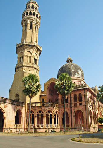
Pictures
Historical Weather
Related Locations
Information of geographic nature is based on public data provided by geonames.org, CIA world facts book, Unesco, DBpedia and wikipedia. Weather is based on NOAA GFS.