-
You are here:
- Homepage »
- Indonesia »
- Nusa Tenggara Barat » Tanahsong Daya

Tanahsong Daya Destination Guide
Explore Tanahsong Daya in Indonesia
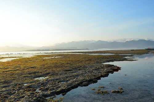
Tanahsong Daya in the region of Nusa Tenggara Barat is a town in Indonesia - some 656 mi or ( 1055 km ) East of Jakarta , the country's capital city .
Current time in Tanahsong Daya is now 11:25 AM (Friday) . The local timezone is named " Asia/Makassar " with a UTC offset of 8 hours. Depending on the availability of means of transportation, these more prominent locations might be interesting for you: Makassar, Surabaya, Singaraja, Selengen, and Praya. Since you are here already, make sure to check out Makassar . We encountered some video on the web . Scroll down to see the most favourite one or select the video collection in the navigation. Where to go and what to see in Tanahsong Daya ? We have collected some references on our attractions page.
Videos
Turtle in Gili Air
Diving trip taken in Gili Air, Lombok with Dream Divers ..
Traveling Along The Lombok Coast to Senaru, Indonesia
www.TravelsWithSheila.com It is only a two-hour ride from Senggigi to Senaru, the jumping off point for trekking up Mount Rinjani. A beautiful drive along the coast with black volcanic sand beaches. A ..
Snorkel in Indonesia
Some footage of fish, taken with a cheap chinese camera at Gili Air, Komodo and Rinca in Indonesia. ..
Wini plays the Tabla in Gili Air
Recorded january 2008 in Gili Air, an island near Lombok, Indonesia ..
Videos provided by Youtube are under the copyright of their owners.
Interesting facts about this location
Gili Islands
The Gili Islands (Indonesian: Tiga Gili, Kepulauan Gili) are an archipelago of three small islands — Gili Trawangan, Gili Meno and Gili Air — just off the northwest coast of Lombok, Indonesia. The islands are a popular destination for Western tourists looking for a remote island experience. Each island has several small resorts, usually consisting of a collection of huts for tourists, a small pool and restaurant.
Located at -8.35 116.06 (Lat./Long.); Less than 12 km away
Senggigi
Senggigi is the main tourist strip of the Indonesian island of Lombok, stretched out along the several kilometers of the beachfront, just to the north of the capital Mataram. The site of a building frenzy in the late 1990s when Lombok was hyped to be the next Bali, the communal violence of 2000 and the 2002 Bali bombing dealt Senggigi a severe blow, with tourist numbers declining precipitously and many construction projects halted.
Located at -8.50 116.05 (Lat./Long.); Less than 21 km away
Selaparang Airport
Selaparang Airport, was the sole airport serving the island of Lombok and the city of Mataram, the capital of the province of West Nusa Tenggara, Indonesia up until its closure on 30 September 2011. The IATA code AMI came from the nearby port of Ampenan, now a part of Mataram. The airport was operated by PT. Angkasa Pura 1 (PERSERO).
Located at -8.56 116.09 (Lat./Long.); Less than 25 km away
Lombok Institute of Flight Technology
Lombok Institute of Flight Technology, also known as LIFT, is an Indonesian higher learning institution specializing in theoretical and practical aeronautical science education. Based on Lombok island (approx 60 miles east of Bali island) the institute received its educational accreditation as a flight academy from Directorate General of Civil Aviation of Indonesia in 2010. The institute operates from Selaparang Airport in Mataram.
Located at -8.56 116.09 (Lat./Long.); Less than 25 km away
Lombok
Lombok is an island in West Nusa Tenggara (Nusa Tenggara Barat or NTB) province, Indonesia. It forms part of the chain of the Lesser Sunda Islands, with the Lombok Strait separating it from Bali to the west and the Alas Strait between it and Sumbawa to the east. It is roughly circular, with a "tail" to the southwest, about 70 km across and a total area of about 4,725 km² (1,825 sq mi). The provincial capital and largest city on the island is Mataram.
Located at -8.56 116.35 (Lat./Long.); Less than 31 km away
Pictures
Historical Weather
Related Locations
Information of geographic nature is based on public data provided by geonames.org, CIA world facts book, Unesco, DBpedia and wikipedia. Weather is based on NOAA GFS.