Explore Monastir in Italy
Monastir in the region of Sardinia with its 4,496 inhabitants is a town in Italy - some 250 mi or ( 402 km ) South-West of Rome , the country's capital city .
Current time in Monastir is now 11:53 PM (Monday) . The local timezone is named " Europe/Rome " with a UTC offset of 1 hours. Depending on the availability of means of transportation, these more prominent locations might be interesting for you: Tunis, Villasor, Villacidro, Terralba, and Sinnai. Since you are here already, make sure to check out Tunis . We saw some video on the web . Scroll down to see the most favourite one or select the video collection in the navigation. Where to go and what to see in Monastir ? We have collected some references on our attractions page.
Videos
dinosauri
Un tuffo nel passato dacar-artisticando.blogspot.com ..
The Future Architecture Of DUBAI
Some projects of future Dubai signed by Rem Koolhaas, Zahah Hadid, Norman Foster, James Law ecc.. Dubai the wonderful city of the future ..
Wilbur in Cagliari: Typical Italian Coffee Break
www.wilbur.asia Welcome to Field Trips. Increase your CQ!!! In this video you will travel with Wilbur to the beautiful island of Sardegna and have a typical coffee Break! Special song by Gianluca Belf ..
a.cagno's Prerogative by ThePerformer FEAT Jago prod HERO
a.cagno's videoclip from Prerogative by ThePerformer FEATURIN' Jago from album "BRAINSTORMIN' music from the black courtain" prod by HERO. DANcE HALL shootin' in Serramanna & Cagliari AUTOPRODUZIONE u ..
Videos provided by Youtube are under the copyright of their owners.
Interesting facts about this location
Decimomannu Air Base
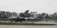
Decimomannu Air Base is an Italian Air Force (Aeronautica Militare) air force base located approximately 5 km north of Decimomannu a comune in the Province of Cagliari on the island of Sardinia in Italy. The base is a front-line NATO training facility primarily used since 1979 for Dissimilar Air Combat Training (DACT) of various NATO air force fighter aircraft.
Located at 39.35 8.97 (Lat./Long.); Less than 7 km away
Dolianova Cathedral
Dolianova Cathedral, dedicated to Saint Pantaleon (Italian: Cattedrale di San Pantaleo, Duomo di Dolianova) is a church in the historical center of Dolianova, Sardinia, Italy, one of the main Romanesque buildings in the island. Formerly the episcopal seat of the diocese of Dolia, it is now a co-cathedral in the Archdiocese of Cagliari.
Located at 39.38 9.17 (Lat./Long.); Less than 11 km away
Cixerri
The Cixerri is an Italian river in southern Sardinia province of Cagliari. It springs from Monte Croccoriga, at 313 m above sea level, in the province of Carbonia-Iglesias. The river flows into a lake north of Iglesias and then exist the lake and flows eastward. The river is joined by a tributary north of Villamassargia and south of Musei before entering the province of Cagliari. The river flows past Siliqua and is joined by another tributary from the south.
Located at 39.27 9.00 (Lat./Long.); Less than 14 km away
Cagliari Elmas Airport
Cagliari Elmas Airport is an international airport located in the territory of Elmas, near Cagliari, on the island of Sardinia, Italy. The airport was upgraded in 2003 and the terminal was expanded and provided with 6 loading bridges for passenger boarding, with a capacity of 4 millions passengers per year. In 2011 the airport handled 3.698.982 passengers.
Located at 39.25 9.05 (Lat./Long.); Less than 15 km away
Teatro Lirico (Cagliari)
The Teatro Lirico di Cagliari is an opera house in Cagliari. It is the main theatre of the city. It was built to substitute the Teatro Civico, seriously damaged by the shelling of Cagliari operated by the Allies during World War II. After the war in Cagliari there wasn't a suitable theatre. The project, by the Italian architects Luciano Galmozzi, Pierfrancesco Ginoulhiac e Teresa Ginoulhiac Arslan, won a bid for the contract in 1967. The opera house was inaugurated in 1993.
Located at 39.23 9.12 (Lat./Long.); Less than 19 km away
Pictures
Historical Weather
Related Locations
Information of geographic nature is based on public data provided by geonames.org, CIA world facts book, Unesco, DBpedia and wikipedia. Weather is based on NOAA GFS.


