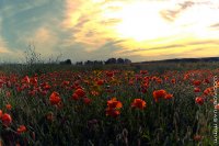
Delve into Villanovaforru in Italy
Villanovaforru in the region of Sardinia with its 700 residents is located in Italy - some 245 mi or ( 395 km ) South-West of Rome , the country's capital .
Local time in Villanovaforru is now 09:00 PM (Friday) . The local timezone is named " Europe/Rome " with a UTC offset of 1 hours. Depending on your mobility, these larger destinations might be interesting for you: Tunis, Villanovafranca, Villamar, Villacidro, and Tuili. While being here, you might want to check out Tunis . We discovered some clip posted online . Scroll down to see the most favourite one or select the video collection in the navigation. Are you curious about the possible sightseeing spots and facts in Villanovaforru ? We have collected some references on our attractions page.
Videos
Carnevale Sanlurese 2011-Gruppo H2o part 1 HD720p
Gruppo H2o ..
Templari
Festa S. Isidoro Villacidro ..
XVIII° Edizione Carnevale SanGavinese 2011-HD720p 1 di 12-
18° Carnevale SanGavinese by: SanGavino.Net ..
Gonnostramatza-festeggiamenti in onore di S.Paolo
Gonnostramatza-festeggiamenti i onore di S.Paolo. Il rosario recitato in SARDO ..
Videos provided by Youtube are under the copyright of their owners.
Interesting facts about this location
Su Nuraxi di Barumini
Su Nuraxi is a nuragic archaeological site in Barumini, Sardinia, Italy. It was inscribed on the UNESCO list of World Heritage Sites in 1997 as Su Nuraxi di Barumini. Su Nuraxi simply means "the nuraghe" in Campidanese, the southern variant of Sardinian. The complex is centred around a three-storey tower built around the 16th century BC. At this site Italian archaeologist Giovanni Lilliu discovered a fortified village that at times had been covered by ground and had become a hill.
Located at 39.71 8.99 (Lat./Long.); Less than 13 km away
Giara di Gesturi
The Giara di Gesturi, Sardinian: Sa Jara Manna, is a high and steep-sided basaltic plateau which extends for about 42 km in the comuni of Gesturi, Tuili and Setzu in the province of Medio Campidano, and Genoni in the province of Oristano, in the southern central part of the island of Sardinia, Italy. The plateau was formed some 2.7 million years ago when lava from the cones of Zepparedda (609 m) and Zeppara Manna (580 m) covered older sedimentary rock.
Located at 39.76 8.95 (Lat./Long.); Less than 16 km away
Ales Cathedral (Sardinia)
Ales Cathedral (Italian: Duomo di Ales, Cattedrale dei Santi Pietro e Paolo) is the parish church of Ales, a small town in the province of Oristano, Sardinia, Italy, and the cathedral of the diocese of Ales-Terralba (the diocesan museum is also located there). The dedication is to Saints Peter and Paul.
Located at 39.77 8.82 (Lat./Long.); Less than 16 km away
Flumini Mannu
The Flumini Mannu is a river in southern Sardinia, Italy. Its springs are located in the hills east of Sardara. It flows into the Stagno di San Giovanni after a course of 42.14 km. The river's main tributaries are the Riu Bellu and the Rio Sitzerri, which for most of the basin of Monte Linas massif's waters.
Located at 39.60 8.68 (Lat./Long.); Less than 16 km away
Monte Arci
The Monte Arci is an isolated massif in the Uras plain in Campidano, Sardinia, Italy. It is composed by three volcanic basalt towers, the highest one reaching an elevation of 812 m. The inner part of the massif is composed of trachyte. Monte Arci had a relevant historical role in Sardinia due to the abundant presence of obsidian, which was used since prehistoric times for weapons and tools, and was later traded outside the island. There are also quarries of pearlite.
Located at 39.77 8.75 (Lat./Long.); Less than 19 km away
Pictures
Historical Weather
Related Locations
Information of geographic nature is based on public data provided by geonames.org, CIA world facts book, Unesco, DBpedia and wikipedia. Weather is based on NOAA GFS.


