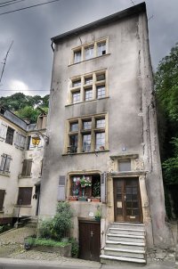
-
You are here:
- Homepage »
- Luxembourg »
- Grevenmacher » Elvange-les-Burmerange

Elvange-les-Burmerange Destination Guide
Delve into Elvange-les-Burmerange in Luxembourg
Elvange-les-Burmerange in the region of Grevenmacher with its 713 residents is located in Luxembourg - some 11 mi or ( 18 km ) South-East of Luxembourg , the country's capital .
Local time in Elvange-les-Burmerange is now 09:14 AM (Tuesday) . The local timezone is named " Europe/Luxembourg " with a UTC offset of 1 hours. Depending on your mobility, these larger destinations might be interesting for you: The Hague, Haarlem, Amsterdam, Brussels, and Saarbrücken. While being here, you might want to check out The Hague . We discovered some clip posted online . Scroll down to see the most favourite one or select the video collection in the navigation. Are you curious about the possible sightseeing spots and facts in Elvange-les-Burmerange ? We have collected some references on our attractions page.
Videos
Na kole z Falckého lesa do Lucemburska
3. část z cyklistického putování z Prahy do Schengenu a zpět na jaře 2008. ..
Domaine Viticole Schumacher-Knepper - Vin et crémant de Luxembourg / Wein und Cremant aus Luxemburg
Vins et crémants de qualité de la moselle luxembourgeoise (Wintrange/Schengen) - Weine und Cremants von der luxemburger Mosel - Wines and Cremants from the luxembourgish Mosel ..
Aschermittwoch in Remich(Luxembourg)
Aschermittwoch werfen die Remicher eine Strohpuppee in die Mosel ..
Léifraweschdag Greiweldeng
Fête du vin le 15 août à Greiveldange (Grand-Duché de Luxembourg) ..
Videos provided by Youtube are under the copyright of their owners.
Interesting facts about this location
Burmerange
Burmerange is a commune and village in south-eastern Luxembourg. It is part of the canton of Remich, which is part of the district of Grevenmacher. As of 2001, the village of Burmerange, which lies in the south-east of the commune, had a population of 173. Other settlements within the commune include Elvange.
Located at 49.48 6.32 (Lat./Long.); Less than 2 km away
Mondorf-les-Bains
Mondorf-les-Bains is a commune and town in south-eastern Luxembourg. It is part of the canton of Remich, which is part of the district of Grevenmacher. Mondorf-les-Bains is a spa town (hence its name), and has the only casino in Luxembourg. As of 2005, the town of Mondorf-les-Bains, which lies in the south-east of the commune, has a population of 2,812. Other towns within the commune include Altwies and Ellange.
Located at 49.50 6.28 (Lat./Long.); Less than 2 km away
Wellenstein
Wellenstein is a commune and small town in south-eastern Luxembourg. It is part of the canton of Remich, which is part of the district of Grevenmacher. The commune's administrative centre is Bech-Kleinmacher. As of 2005, the town of Wellenstein, which lies in the centre of the commune, has a population of 453. Other towns within the commune include Bech-Kleinmacher and Schwebsange.
Located at 49.52 6.35 (Lat./Long.); Less than 3 km away
Remerschen
Remerschen is a former commune and small wine-growing town in south-eastern Luxembourg, belonging to the commune of Schengen, near the point where the borders of Germany, France and Luxembourg come together. As of 2005, the town of Remerschen, which lies in the centre of the commune, has a population of 637. To use the name recognition of the town of Schengen, the council of the commune of Remerschen decided on 18 January 2006 to rename the commune to Schengen.
Located at 49.48 6.35 (Lat./Long.); Less than 3 km away
Markusbierg Tunnel
The Markusbierg tunnels are a pair of parallel tunnels, which form the most easterly section of the A13 motorway through Luxembourg, near the town of Schengen. The tunnels are 1575 metres in length, and descend easterly, towards the German border at a 5% gradient. The eastern end of the tunnel runs directly to a viaduct crossing the Moselle River, which forms the border with Germany.
Located at 49.48 6.35 (Lat./Long.); Less than 4 km away
Pictures
Historical Weather
Related Locations
Information of geographic nature is based on public data provided by geonames.org, CIA world facts book, Unesco, DBpedia and wikipedia. Weather is based on NOAA GFS.

