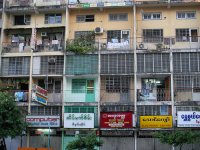
Explore Syriam in Myanmar
Syriam in the region of Yangon with its 69,448 inhabitants is a town in Myanmar - some 206 mi or ( 331 km ) South of Nay Pyi Taw , the country's capital city .
Current time in Syriam is now 12:44 PM (Tuesday) . The local timezone is named " Asia/Rangoon " with a UTC offset of 6.5 hours. Depending on the availability of means of transportation, these more prominent locations might be interesting for you: Tha Song Yang, Mae La Noi, Lampang, Chiang Mai, and Yegyaungwa. Since you are here already, make sure to check out Tha Song Yang . We encountered some video on the web . Scroll down to see the most favourite one or select the video collection in the navigation. Where to go and what to see in Syriam ? We have collected some references on our attractions page.
Videos
アキーラさん夜の市内散策!ミャンマー・ヤンゴン市街4,Yangon,Myanmer
I went to Yangon in Myanmer on Jul in 2011 and visited many places there. I walked aroun the city in Yangon. This city is safty city for sight-seeing and the people are kind. I can recommend you to vi ..
Yangon City Centre
© zoqy.net A quick look at some of the sights and sounds on Yangon (Rangoon) city centre. ..
Shwedagon Pagoda
Much more at allmyanmar.com The Shwedagon Pagoda is in the center of the pagoda platform there are are dozens of other Buddhist Shrines grouped around. It is said the at the pagoda is around 2000 year ..
Yangon Botanical Garden
Dear viewers over the world.If you really want to enjoy Asia,its fantastic culture, breathtaking nature and beautiful, nice people then you should visit Myanmar.There is no other city in the world wit ..
Videos provided by Youtube are under the copyright of their owners.
Interesting facts about this location
University of East Yangon
The University of East Yangon, located in Thanlyin in the southeastern suburbs of Yangon, is a liberal arts and sciences university in Myanmar. The university offers bachelor's degree programs in liberal arts and science and law. A train service opened in 2006 connects the university campus to downtown Yangon. About 2000 students use the service daily.
Located at 16.74 96.29 (Lat./Long.); Less than 7 km away
Botataung Pagoda
The Botataung Pagoda (also spelled Botahtaung; literally "1000 military officers") is a famous pagoda located in downtown Yangon, Myanmar, near the Yangon river. The pagoda was first built by the Mon around the same time as was Shwedagon Pagoda—according to local belief, over 2500 years ago, and was known as Kyaik-de-att in Mon language. The pagoda is hollow within, and houses what is believed to be a sacred hair of Gautama Buddha.
Located at 16.77 96.17 (Lat./Long.); Less than 7 km away
Thuwunna Stadium
Thuwunna Youth Training Center Stadium (or more commonly Thuwunna YTC Stadium) is a multi-use stadium, located in Yangon, Myanmar. The 32,000-seat stadium is smaller but more up-to-date than Aung San Stadium, and is the venue of choice for most national and international level football and track and field competitions. The stadium's eight-lane runway is the first in Myanmar that conforms to the international standards. It is currently being upgraded to a seating capacity of 50,000 spectators.
Located at 16.82 96.19 (Lat./Long.); Less than 8 km away
Saint Mary's Cathedral, Yangon
Saint Mary's Cathedral is a Catholic cathedral located on Bo Aung Kyaw Street in Botahtaung Township, Yangon, Burma. The cathedral's exterior, of red brick, consists of spires and a bell tower. It was designed by Dutch architect Jos Cuypers, son of Pierre Cuypers. The cathedral is the largest in Burma. Located on the grounds of the cathedral is Basic Education High School No.
Located at 16.78 96.17 (Lat./Long.); Less than 8 km away
Kandawgyi Lake
Kandawgyi Lake (literally "great royal lake", formerly Royal Lake), is one of two major lakes in Yangon, Burma (Myanmar). Located east of the Shwedagon Pagoda, the lake is artificial; water from Inya Lake is channelled through a series of pipes to Kandawgyi Lake. It was created to provide a clean water supply to the city during the British colonial administration. It is approximately 5 miles (8 km) in circumference, and has a depth of 20 to 45 inches (50 to 115 cms).
Located at 16.80 96.17 (Lat./Long.); Less than 8 km away
Pictures
Historical Weather
Related Locations
Information of geographic nature is based on public data provided by geonames.org, CIA world facts book, Unesco, DBpedia and wikipedia. Weather is based on NOAA GFS.


