-
You are here:
- Homepage »
- Netherlands »
- North Brabant » S Gravenmoer

S Gravenmoer Destination Guide
Discover S Gravenmoer in Netherlands
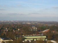
S Gravenmoer in the region of North Brabant with its 2,200 habitants is a town located in Netherlands - some 50 mi or ( 80 km ) South of Amsterdam , the country's capital .
Local time in S Gravenmoer is now 08:40 AM (Tuesday) . The local timezone is named " Europe/Amsterdam " with a UTC offset of 1 hours. Depending on your flexibility, these larger cities might be interesting for you: Woudrichem, Werkendam, Waalwijk, Tilburg, and S-Gravenmoerse Vaart. When in this area, you might want to check out Woudrichem . We found some clip posted online . Scroll down to see the most favourite one or select the video collection in the navigation. Are you looking for some initial hints on what might be interesting in S Gravenmoer ? We have collected some references on our attractions page.
Videos
Rock Shox Recon Silver
Short easy ride on a sunny spring day to test a new camera and camera position. Rock Shox Recon seems to do it's job very well. ..
Amsterdam Ratha Yatra 2009
Shivatma, Holger (rechts) und Sascha haben sich auf dem Weg gemacht, das Ratha-Yatra-Festival in der Stadt der Grachten zu besuchen. ..
Molly Malone Piano Cover
Improvisation of Molly Malone ("Molly Malone" (also known as "Cockles and Mussels" or "In Dublin's Fair City") is a popular song, set in Dublin, Ireland, which has become the unofficial anthem of Dubl ..
European Tour Vol.3
European Tour Vol.3 ..
Videos provided by Youtube are under the copyright of their owners.
Interesting facts about this location
's Gravenmoer
's Gravenmoer is a village in the Dutch province of North Brabant. It is located in the municipality of Dongen, about 3 km north of the town of Dongen. The village has a population of about 2190 inhabitants, including the farmlands to the north of the village. 's Gravenmoer was a separate municipality until 1997, when it became a part of Dongen.
Located at 51.66 4.94 (Lat./Long.); Less than 0 km away
Waspik
Waspik is a village in the Dutch province of Noord-Brabant. It is located in the municipality of Waalwijk. Waspik was a separate municipality until 1997, when it became part of Waalwijk. Waspik came to national attention in 2007 when a Liberian family was forced to flee the village after repeated racist attacks. An official report into events in the village concluded that everyone involved in the affair including the town council and housing corporations had failed to protect the family.
Located at 51.68 4.95 (Lat./Long.); Less than 3 km away
Donge (river)
The Donge is a river in the Dutch province of Noord-Brabant. It rises near the village Dongen and flows north to the city of Geertruidenberg where it's continued by the Amer together with the Bergse Maas.
Located at 51.68 4.91 (Lat./Long.); Less than 3 km away
Raamsdonk
Raamsdonk is a village in the Dutch province of North Brabant. It is located in the municipality of Geertruidenberg, about 15 km northeast of Breda. Raamsdonk was a separate municipality until 1997, when it became part of Geertruidenberg.
Located at 51.68 4.92 (Lat./Long.); Less than 3 km away
North Brabant
North Brabant, since 2001 Brabant is also unofficially used, is a province of the Netherlands, located in the south of the country, bordered by Belgium's Antwerp and Limburg provinces in the south, the Meuse River (Maas) in the north, and Limburg in the east and Zeeland in the west.
Located at 51.67 5.00 (Lat./Long.); Less than 4 km away
Pictures
Historical Weather
Related Locations
Information of geographic nature is based on public data provided by geonames.org, CIA world facts book, Unesco, DBpedia and wikipedia. Weather is based on NOAA GFS.


