-
You are here:
- Homepage »
- Netherlands »
- South Holland » Vlaardingen

Vlaardingen Destination Guide
Explore Vlaardingen in Netherlands
Vlaardingen in the region of South Holland with its 73,798 inhabitants is a place in Netherlands - some 39 mi or ( 64 km ) South-West of Amsterdam , the country's capital city .
Time in Vlaardingen is now 08:30 PM (Monday) . The local timezone is named " Europe/Amsterdam " with a UTC offset of 1 hours. Depending on your budget, these more prominent locations might be interesting for you: Zouteveen, Zoetermeer, Windas, Vlaardingen, and Utrecht. Since you are here already, consider visiting Zouteveen . We saw some hobby film on the internet . Scroll down to see the most favourite one or select the video collection in the navigation. Where to go and what to see in Vlaardingen ? We have collected some references on our attractions page.
Videos
Dj Mr Coolkat Crazy Dance kats mix 9
Dj Mr Coolkat Crazy Dance kats mix 9 Tracklist: Intro Michael Jackson - Dirty Diana Dj Porny - Me so Horney Alf - Stuck on earth 200 - The Darkness S Express - Theme from S Express Level 42 - Heaven I ..
Gunz dungeon quest for lvl 1 - 5
This is my first video, the music sucks, but..... more (way) better videos to come! ..
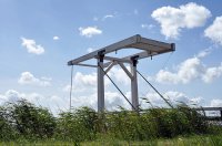
Spotten met Zeearend09: SGMm sprinters over de bovenleidingloze Havenbrug in Vlaardingen
Sprinters over de prachtige spanningloze Havenbrug vlak bij station Vlaardingen. Je ziet bij de laatste video duidelijk dat de stroomafnemer heel even naar beneden gaat. Ik kan het me niet voorstellen ..
JTS Musical - Anatevka - Koppelaar
For the english discription sroll. NL: Dit is het lied koppelaar van Anatevka. Opgevoerd door de Jeugd theater school Vlaardingen. De eerste die zingt ben ik. Het was super leuk! Hodel: Lisa van Harme ..
Videos provided by Youtube are under the copyright of their owners.
Interesting facts about this location
Battle of Vlaardingen (1351)
There was a civil war in Holland and Hainaut (which was in a personal union with Holland) in 1350 between the Hooks and the Cods. The Hooks were fighting for the Countess Margaret of Hainault, supported by England, while the Cods were fighting for Margaret's son William, who was ruling Holland in name of Margaret. William defeated the Hooks and the English in the Battle of Vlaardingen in 1351.
Located at 51.91 4.34 (Lat./Long.); Less than 0 km away
Vlaardinger-Ambacht
Vlaardinger-Ambacht is a former municipality in the Dutch province of South Holland. It covered the countryside around the city of Vlaardingen. The municipality existed between 1817 and 1941, when it became part of Vlaardingen.
Located at 51.92 4.33 (Lat./Long.); Less than 1 km away
Vlaardingen
Vlaardingen is a city in South Holland in the Netherlands. It is located on the north bank of the Nieuwe Maas/Nieuwe Waterweg river at the confluence with the Oude Maas. The municipality administers an area of 26.71 square kilometres, of which 23.81 square kilometres is land, with 71,938 residents (in May 2006).
Located at 51.90 4.33 (Lat./Long.); Less than 2 km away
Nieuwland, Kortland, en 's-Graveland
Nieuwland, Kortland, en 's-Graveland (often abbreviated to "Nieuwland c.a. ") is a former municipality in the Dutch province of South Holland. It was located on three sides of the city of Schiedam. The municipality existed between 1817 and 1855. The municipality consisted of three polders: Kortland, west of Schiedam; Nieuwland, north of the city; and 's-Graveland, northeast of the city. Nieuwland is now the name of a neighbourhood of Schiedam, located in the former municipality.
Located at 51.92 4.39 (Lat./Long.); Less than 3 km away
Langebakkersoord
Langebakkersoord is a former municipality in the Dutch province of South Holland. It was located northwest of Hoogvliet, on the confluence of the Oude Maas and Nieuwe Maas rivers. Langebakkersoord was a separate municipality between 1817 and 1826, when it merged with Pernis.
Located at 51.88 4.33 (Lat./Long.); Less than 3 km away
Pictures
Historical Weather
Related Locations
Information of geographic nature is based on public data provided by geonames.org, CIA world facts book, Unesco, DBpedia and wikipedia. Weather is based on NOAA GFS.

