-
You are here:
- Homepage »
- Netherlands »
- Zeeland » Breskens

Breskens Destination Guide
Discover Breskens in Netherlands
Breskens in the region of Zeeland is a town located in Netherlands - some 88 mi or ( 142 km ) South-West of Amsterdam , the country's capital .
Local time in Breskens is now 06:15 PM (Saturday) . The local timezone is named " Europe/Amsterdam " with a UTC offset of 1 hours. Depending on your flexibility, these larger cities might be interesting for you: London, Cambridge, Flushing, Veere, and The Hague. When in this area, you might want to check out London . We found some clip posted online . Scroll down to see the most favourite one or select the video collection in the navigation. Are you looking for some initial hints on what might be interesting in Breskens ? We have collected some references on our attractions page.
Videos
KNRM Lifeguard Boat surfing wake
Breskens-Vlissingen (catamaran) ferry, Zeeland, The Netherlands ..
Olau Line 1990
Überfahrt nach England mit den "neuen" Olau Hollandia und Olau Britannia Crossing the English Channel with the "new" Olau Hollandia and Olau Britannia ..
Olau Line 1988
Überfahrt nach England mit den "alten" Olau Hollandia und Olau Britannia Crossing the English Channel with the "old" Olau Hollandia and Olau Britannia ..
ellis jane sings neither one of us
From "Soul City" (Ellis Jane and the musical company) live at the Arsenaal Theater, Vlissingen 2007 ..
Videos provided by Youtube are under the copyright of their owners.
Interesting facts about this location
Breskens
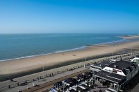
Breskens is a harbour town on the Westerschelde in the municipality of Sluis in the province of Zeeland, in the south-western Netherlands. Its population is 4,809. The town is noted for the Visserijfeesten (Fishery Festival), the largest festival in Zeeland. A ferry connection exists between Breskens and Vlissingen. After the opening of the Westerschelde tunnel near Terneuzen in 2003, the ferry now only carries pedestrian and bicycle traffic.
Located at 51.40 3.55 (Lat./Long.); Less than 1 km away
List of shipwrecks in 1910
The list of shipwrecks in 1910 includes all ships sunk, foundered, grounded, or otherwise lost during 1910.
Located at 51.42 3.59 (Lat./Long.); Less than 4 km away
Groede
Groede is a village in the Dutch province of Zeeland. It is located about 5 km north of Oostburg in the municipality of Sluis. Groede was a separate municipality until 1970.
Located at 51.38 3.50 (Lat./Long.); Less than 4 km away
Scheldt
The Scheldt (French Escaut) is a 350 km long river in northern France, western Belgium and the southwestern part of the Netherlands. Its name is derived from an adjective corresponding to Old English sceald "shallow", Modern English shoal, Low German schol, Frisian skol, and Swedish skäll "thin".
Located at 51.43 3.53 (Lat./Long.); Less than 4 km away
Schoondijke
Schoondijke is a village in the Dutch province of Zeeland. It is located in the municipality of Sluis, about 5 km south of Breskens. Schoondijke was a separate municipality until 1970, when it was merged with Oostburg.
Located at 51.35 3.55 (Lat./Long.); Less than 5 km away
Pictures
Historical Weather
Related Locations
Information of geographic nature is based on public data provided by geonames.org, CIA world facts book, Unesco, DBpedia and wikipedia. Weather is based on NOAA GFS.


