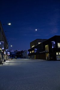
Delve into Bjornevatn in Norway
Bjornevatn in the region of Finnmark with its 2,392 residents is located in Norway - some 872 mi or ( 1404 km ) North-East of Oslo , the country's capital .
Local time in Bjornevatn is now 01:06 PM (Saturday) . The local timezone is named " Europe/Oslo " with a UTC offset of 1 hours. Depending on your mobility, these larger destinations might be interesting for you: Murmansk, Borisoglebsk, Pelkosenniemi, Kuusamo, and Kemijärvi. While being here, you might want to check out Murmansk . We discovered some clip posted online . Scroll down to see the most favourite one or select the video collection in the navigation. Are you curious about the possible sightseeing spots and facts in Bjornevatn ? We have collected some references on our attractions page.
Videos
KIRKENES (NORWAY) 19.08.2009
KIRKENES (NORWAY) 19.08.2009 CONFINE RUSSIA STRADA PER MURMANSK ..
Arctic Adventure
► Twitter- www.twitter.com ► Music by Stephen Anderson, check out his brilliant music at www.stephenjanderson.com. Filmed in Norway Circle. I really wanted to get a timelapse of the Northern Lights, b ..
Hurtigruten Video 1/3
Von Kirkenes nach Bergen ..
Barents Spektakel 2009
Borders Control or Rock-n-roll? Nikel — Kirkenes, 23.01. - 01.02.2009 ..
Videos provided by Youtube are under the copyright of their owners.
Interesting facts about this location
Bjørnevatn Station
Bjørnevatn Station is a former railway station, located at Bjørnevatn in Sør-Varanger, Norway, that was the terminus of the Kirkenes–Bjørnevatn Line.
Located at 69.67 30.00 (Lat./Long.); Less than 1 km away
Kirkenes–Bjørnevatn Line
The Kirkenes–Bjørnevatn Line, or the Sydvaranger Line (Sydvarangerbanen), is a 8.5-kilometer long railway line between Kirkenes and Bjørnevatn in Sør-Varanger, Norway. Owned by the private mining company Northern Iron, the single-track railway is solely used to haul 20 daily iron ore trains from Bjørnevatn Mine to the port at Kirkenes. It was the world's northern-most railway until 2010.
Located at 69.71 30.03 (Lat./Long.); Less than 6 km away
Kirkenes Station
Kirkenes Station is a former railway station, located at Kirkenes in Sør-Varanger, Norway, that was the terminus of the Kirkenes–Bjørnevatn Line.
Located at 69.72 30.03 (Lat./Long.); Less than 6 km away
Centre for High North Logistics
Centre for High North Logistics (CHNL, Norwegian: Senter for nordområdelogistikk) is a Norwegian foundation which works to investigate ways to develop logistics solutions in the Arctic region. Among the aims of the centre is that of collecting information to facilitate an opening up of the Northern Sea Route from the Atlantic Ocean to the Pacific Ocean. The administration of the center is located in Kirkenes on the north-eastern Barents Sea coast of Norway.
Located at 69.73 30.04 (Lat./Long.); Less than 7 km away
Kirkenes Church
Kirkenes Church is the main parish church in Sør-Varanger Municipality in Finnmark county, Norway. It is located in the town of Kirkenes, just off the European route E6 highway. The church is part of the Sør-Varanger parish in the Varanger deanery in the Diocese of Nord-Hålogaland. The concrete and wood church was built in 1959 and it seats about 275 people.
Located at 69.73 30.04 (Lat./Long.); Less than 7 km away
Pictures
Historical Weather
Related Locations
Information of geographic nature is based on public data provided by geonames.org, CIA world facts book, Unesco, DBpedia and wikipedia. Weather is based on NOAA GFS.


