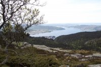
Explore Espeland in Norway
Espeland in the region of Hordaland with its 1,793 inhabitants is a town in Norway - some 184 mi or ( 297 km ) West of Oslo , the country's capital city .
Current time in Espeland is now 12:42 AM (Sunday) . The local timezone is named " Europe/Oslo " with a UTC offset of 1 hours. Depending on the availability of means of transportation, these more prominent locations might be interesting for you: Ytre Arna, Stavanger, Mirza Rafi Sauda, Rodland, and Oyjordi. Since you are here already, make sure to check out Ytre Arna . We saw some video on the web . Scroll down to see the most favourite one or select the video collection in the navigation. Where to go and what to see in Espeland ? We have collected some references on our attractions page.
Videos
Fjord Cruise
Some images from a cruise round the Norwegian Fjords ..
Eine kleine Marschmusik
Eine kleine Marschmusik ..
Roadtrip to Norway. Summer 2011.
Поездка к фьордам 29.07.2011-10.08.2011. Санкт-Петербург-Хельсинки-Стокгольм-Осло-Кинсарвик-Берген-Твиндефоссен-Лэердал-Гейло-Вегли ..
Reppadalen Nature Reserve - Bergen, Norway
Some rainy days in the Reppadalen Nature Reserve, in Bergen, Norway. August 2009. On Google Earth: 60°24'12 - N 5°30,28 E Music: Dune - Prophecy Theme (Brian Eno) ..
Videos provided by Youtube are under the copyright of their owners.
Interesting facts about this location
Espeland
Espeland is a village in Arna borough in Bergen, Norway. As of January 1, 2008, the population of the Espeland urban area is 1937. The urban area covers a land area of 2.14 square kilometres, and has a population density of 905 per square kilometre. Espeland is known for the Espeland concentration camp, built by Germans 1942–1943.
Located at 60.38 5.47 (Lat./Long.); Less than 0 km away
Ulriken Tunnel
Ulriken Tunnel is a railway tunnel on the Bergen Line between Bergen Station and Arna Station in Norway. The 7,670-meter long tunnel runs under the northern part of the mountain Ulriken in Bergen. Before the tunnel was opened in 1964, the Bergen Line ran via Nesttun. This stretch is now a heritage railway, the Old Voss Line. The tunnel has single track and is electrified. The Norwegian National Rail Administration has plans for building a second track through the mountain.
Located at 60.40 5.41 (Lat./Long.); Less than 3 km away
Arna (municipality)
Arna is a former municipality in the county of Hordaland, Norway. Arna, in addition to Fana, Laksevåg and Åsane, was merged with Bergen 1 January 1972. The area of the former municipality is today made up by the borough of Arna.
Located at 60.42 5.47 (Lat./Long.); Less than 4 km away
Indre Arna
Indre Arna is a settlement in Arna borough in Bergen, Norway. While Indre Arna is relatively far from most of the city by road, an 8-minute train journey through Ulriken connects Indre Arna to the city centre. On January 1, 2008, the Indre Arna urban settlement, as defined by Statistics Norway, had a population of 6198. The urban settlement covered a land area of 3.80 square kilometres, and had a population density of 1631 per square kilometre.
Located at 60.42 5.48 (Lat./Long.); Less than 4 km away
Arna Station
Arna Station is the second largest railway station in Bergen, Norway; located in the Arna borough on the east side of Ulriken and between the two tunnels Ulriken Tunnel and Arnanipa. The present station was opened in 1964, when the tunnels was completed. The old station, located north of the new station, is still in use for heritage trains on Gamle Vossebanen. All passenger trains on Bergensbanen stop at Arna.
Located at 60.42 5.47 (Lat./Long.); Less than 4 km away
Pictures
Historical Weather
Related Locations
Information of geographic nature is based on public data provided by geonames.org, CIA world facts book, Unesco, DBpedia and wikipedia. Weather is based on NOAA GFS.


