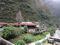
Discover Santa Teresa in Peru
Santa Teresa in the region of Cusco is a town located in Peru - some 309 mi or ( 497 km ) East of Lima , the country's capital .
Local time in Santa Teresa is now 11:53 PM (Monday) . The local timezone is named " America/Lima " with a UTC offset of -5 hours. Depending on your flexibility, these larger cities might be interesting for you: Huánuco, Umasbamba, Puno, Pomachaca, and Ica. When in this area, you might want to check out Huánuco . We found some clip posted online . Scroll down to see the most favourite one or select the video collection in the navigation. Are you looking for some initial hints on what might be interesting in Santa Teresa ? We have collected some references on our attractions page.
Videos
Visit of the Machu Picchu and train
Visit of / Visite du / Besuch von / Visita de / Chiamata di / の訪問 / زياره مانشو بيكو / 访问马丘比丘 / 의 방문 Machu Picchu You can play an other extended version in High Quality with different music : www.yout ..
The legendary lost city of Machu Picchu
The HQ version of this video is available at : www.youtube.com This clip is an extented version of : www.youtube.com (without the train and with different music) en.wikipedia.org (English) es.wikipedi ..
The legendary lost city of Machu Picchu (High Quality)
I have reloaded this old video because old videos are not available in HQ. This clip is an extented version of : www.youtube.com (without the train and with different music) en.wikipedia.org (English) ..
Machu Picchu, Enjoy Peru, Peru Tours, Peru Travel, Cusco, Peru, Machu Picchu, Incas Empire
www.peruvian-tours.com Machu Picchu, Cusco, Peru, The Lost City of the Incas(Quechua Machu Pikchu, "Old Peak") is a pre-Columbian Inca site located 2430 meters (7970 ft) above sea level. It is situate ..
Videos provided by Youtube are under the copyright of their owners.
Interesting facts about this location
Santa Teresa District
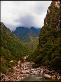
Santa Teresa District is one of ten districts of the province La Convención in Peru. Santa Teresa, Peru is situated 6.5 km northwest of Machu Picchu and is at the axis of several important routes leading to this archeological centre, including alternative paths ways to the ruins (previously the railway was the only means of reaching Machu Picchu). In 1998, a landslide completely buried the town and destroyed that bridge that connected it to Machu Picchu and Cusco.
Located at -13.13 -72.60 (Lat./Long.); Less than 1 km away
Llactapata
Llactapata (also spelled Llaqtapata) is a combination of two Quechua words. The pronunciation of Llactapata is yakta-pahta. Hiram Bingham, discoverer of Machu Picchu and many other Incan sites, states that Llacta Pata is a descriptive term; "llacta" means "town" and "pata" means "a height". Thus, more than one site has been, and is, referred to by this name.
Located at -13.18 -72.59 (Lat./Long.); Less than 5 km away
Temple of the Moon (Peru)
The Temple of the Moon is an Incan ceremonial temple on Huayna Picchu near Machu Picchu, in Peru. The site is made up of stone masonry and an open-face, shallow cave. The temple is arbitrarily named, like many of the sites in Machu Picchu. In the center of the cave is a throne carved out of rock. Beside the throne are steps that lead deeper into the cave. It is thought that the caves were used to hold mummies. The Temple of the Moon dates back 1500 years It was rediscovered in 1936.
Located at -13.15 -72.55 (Lat./Long.); Less than 5 km away
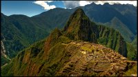
Machu Picchu
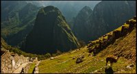
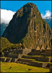
Machu Picchu is a 15th-century Inca site located 2,430 metres above sea level. Machu Picchu is located in the Cusco Region of Peru, South America. It is situated on a mountain ridge above the Urubamba Valley in Peru, which is 80 kilometres northwest of Cusco and through which the Urubamba River flows. Most archaeologists believe that Machu Picchu was built as an estate for the Inca emperor Pachacuti (1438–1472).
Located at -13.16 -72.55 (Lat./Long.); Less than 6 km away
Wiñay Wayna
Wiñay Wayna (Quechua for "forever young", alternatively spelled Huynay Huayna) is an Inca ruin along the Inca Trail to Machu Picchu. It is built into a steep hillside overlooking the Urubamba River. The site consists of upper and lower house complexes connected by a staircase and fountain structures. Above and below the houses the people built areas of agricultural terraces, which are still visible.
Located at -13.19 -72.54 (Lat./Long.); Less than 9 km away
Pictures
Related Locations
Information of geographic nature is based on public data provided by geonames.org, CIA world facts book, Unesco, DBpedia and wikipedia. Weather is based on NOAA GFS.


