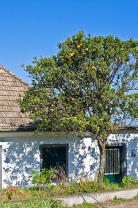
Discover Sao Jorge in Portugal
Sao Jorge in the region of Madeira is a town located in Portugal - some 596 mi or ( 959 km ) South-West of Lisbon , the country's capital .
Local time in Sao Jorge is now 05:32 AM (Thursday) . The local timezone is named " Atlantic/Madeira " with a UTC offset of 0 hours. Depending on your flexibility, these larger cities might be interesting for you: Sao Vicente, Santa Cruz, Ponta Delgada, Nossa Senhora do Monte, and Machico. When in this area, you might want to check out Sao Vicente . We found some clip posted online . Scroll down to see the most favourite one or select the video collection in the navigation. Are you looking for some initial hints on what might be interesting in Sao Jorge ? We have collected some references on our attractions page.
Videos
Madeira - Portugal - The most beautiful sights
The island of Madeira belongs to Portugal and is one of the most beautiful islands in the world. Madeira is a tropical garden with incredible scenery, friendly inhabitants and culinary delights. Who l ..
Pico Ruivo
This is at the top of Pico Ruivo, 1861m high, in Madeira island. It was filmed just after sunrise. ..
Magnificent Madeira
Sequel of Magnificent Berchtesgaden. Just piece of this faboulous island caught by Canon 5DmkII with 24-105IS (that time without IS).Thank you very much... ..
Casa das Hortensias
The "Casa das Hortensias" is a traditional and restored typical Madeiran home set on an apron of some of the island's most magnificent feast of colour and splendour on the rugged, vineyard terraced, a ..
Videos provided by Youtube are under the copyright of their owners.
Interesting facts about this location
São Roque do Faial
São Roque do Faial is a parish in the district of Santana in the Madeira Islands. The population in 2001 is 927, its density is 58.3/km² and the area is 15.9 km². São Roque do Faial is the third smallest in population, the third largest in density and the second smallest in area in Santana. It is located east of Santana and south of Faial. The main industry is agriculture. It is connected with a road linking Santana and Machico. The parish of Machico lies to the east.
Located at 32.77 -16.85 (Lat./Long.); Less than 7 km away
Madeira Natural Park
The Madeira Natural Park (Portuguese: Parque Natural da Madeira) is a large biological reserve in Madeira with a unique endemic flora and fauna. It was created in 1982 to safeguard the natural heritage of the archipelago, and contains a number of endangered species including global rarities such as Zino's Petrel. This national park encompasses nearly two-thirds of the territory of the island of Madeira, and within it are nature reserves, protected landscapes and leisure zones.
Located at 32.75 -17.00 (Lat./Long.); Less than 12 km away
Santo António da Serra (Santa Cruz)
Santo António da Serra (Portuguese for "Saint Anthony" and "mountain range") is a parish in the district of Santa Cruz in the Madeira Islands. The population in 2001 is 982, its density is 66,5/km² and the area is 14.77 km²/1,477 ha. It is located W of Machico and ENE of Funchal. The main industry are agriculture. It's connected with a road to Machico, to Funchal and to Santana (Via Poiso). The mountains encircle Santo António da Serra.
Located at 32.72 -16.82 (Lat./Long.); Less than 14 km away
TAP Portugal Flight 425
TAP Air Portugal Flight 425, tail number CS-TBR, was a Boeing 727 aircraft named Sacadura Cabral en route from Brussels, Belgium, to Madeira Airport (informally known as Funchal Airport), Portugal, with an intermediate scheduled stop in Lisbon, Portugal, on November 19, 1977. It remains TAP Portugal's only fatal accident in its history.
Located at 32.70 -16.77 (Lat./Long.); Less than 18 km away
SA de Transport Aérien Flight 730
SA de Transport Aérien Flight 730, tail number HB-ICK, was a Sud Aviation SE-210 Caravelle 10R aircraft that crashed on approach to Funchal Airport, Madeira on December 18, 1977. The flight crew consisted of two captains. The pilot in command had never previously landed at Funchal and was being trained to operate from the notoriously difficult airport by the other, more experienced captain, who was acting as co-pilot.
Located at 32.70 -16.77 (Lat./Long.); Less than 18 km away
Pictures
Related Locations
Information of geographic nature is based on public data provided by geonames.org, CIA world facts book, Unesco, DBpedia and wikipedia. Weather is based on NOAA GFS.


