-
You are here:
- Homepage »
- Russia »
- Primorskiy » Russkiy

Russkiy Destination Guide
Delve into Russkiy in Russia
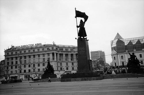
Russkiy in the region of Primorskiy with its 5,080 residents is a city in Russia - some 3,990 mi or ( 6422 km ) East of Moscow , the country's capital .
Current time in Russkiy is now 07:13 PM (Tuesday) . The local timezone is named " Asia/Vladivostok " with a UTC offset of 11 hours. Depending on your travel modalities, these larger destinations might be interesting for you: Vladivostok, Russkiy, Reyneke, Popova, and Podnozh'ye. While being here, make sure to check out Vladivostok . We encountered some video on the web . Scroll down to see the most favourite one or select the video collection in the navigation. Are you curious about the possible sightseeing spots and facts in Russkiy ? We have collected some references on our attractions page.
Videos
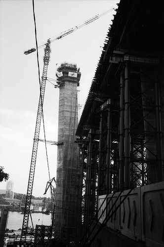
Bridge to Russky Island in Vladivostok
Construction of the cable-stayed bridge to Russky Island over the Eastern Bosphorus Strait in Vladivostok. More information - www.rusbridge.net ..
Прохват по Владивостоку на эндуро.mp4
Прохват по г. Владивостоку на эндуро (honda sl230) (Если Вы увидите нарушение правил, то не беспокойтесь, это монтаж) ..
Ночной Владивосток 2010 Night Vladivostok 2010
Ночной Владивосток 2010 видео снятое из окна автомобиля. Night Vladivostok video taken from car in 2010 ..
ASIA PACIFIC INTERNATIONAL POLE DANCE & ACROBATIC CHAMPIONSHIPS (VLADIVOSTOK)
АЗИАТСКО-ТИХООКЕАНСКИЙ МЕЖДУНАРОДНЫЙ ЧЕМПИОНАТ ПО ТАНЦУ И АКРОБАТИКЕ НА ПИЛОНЕ "ASIA PACIFIC INTERNATIONAL POLE DANCE & ACROBATIC CHAMPIONSHIPS" (VLADIVOSTOK ) VLADIVOSTOK ..
Videos provided by Youtube are under the copyright of their owners.
Interesting facts about this location
Russky Island
Russky Island (Russian: о́стров Ру́сский, lit. Russian island) is an island off Vladivostok, Russia, in the Peter the Great Gulf, Sea of Japan. It is located about 9,334 kilometres east of Moscow. The Eastern Bosphorus separates the island from the Muravyov-Amursky Peninsula. Off the southern shore of Russky Island is Shkot Island; to the southwest lie Popov Island (7 km long, 4.3 km wide), Reyneke Island (3.4 km across) and Rikord Island (4.1 km long and less than 2 km wide).
Located at 43.00 131.85 (Lat./Long.); Less than 3 km away
Eastern Bosphorus
Eastern Bosphorus (Russian: Босфор Восточный, Bosfor Vostochny) is a strait that separates the Muravyov-Amursky Peninsula and Russky Island, and connects Amur Bay and Ussuri Bay. The depth is up to 50 m. It is about 9 km long and only 800 m wide at its narrowest point. Completed in July 2012, Russky Bridge, a cable-stayed bridge connects Russky Island and mainland Vladivostok. As of 2013, the bridge is the longest cable-stayed bridge in the world by the virtue of its span of 1104 m.
Located at 43.07 131.90 (Lat./Long.); Less than 6 km away
Russky Bridge
The Russky Bridge is a bridge built across the Eastern Bosphorus strait, to serve the Asia-Pacific Economic Cooperation that took place in Vladivostok in 2012. The bridge connects the mainland part of the city (Nazimov peninsula) with Russky Island, where the main activities of the summit are to take place. The bridge was completed in July 2012 and opened by Russian Prime Minister Dmitry Medvedev. On September 3, 2012, the bridge was officially given its name.
Located at 43.06 131.91 (Lat./Long.); Less than 6 km away
Ushi Island
Ushi is a small uninhabited island in Amur Bay. It is a part of Eugénie de Montijo Archipelago under Vladivostok administration. Area of an island is 0.1 ha (45 m on 22 m). Its the highest point is 6 m. The island is located 160 m north-west from Russky Island. Ushi island is almost devoid of vegetation life. It consists of two rocks which connected narrow and low isthmus. There are shoals (4.8-5.2 m) near the island.
Located at 43.06 131.80 (Lat./Long.); Less than 6 km away
Diomede Bay
The Diomede Bay is a landlocked inlet of the Peter the Great Gulf in the Russian city of Vladivostok. The bay derives its name from Diomedes, the first Russian brig to cast anchor in the bay back in 1862. The coastline is dotted with run-down fisheries, fishing wharves, and depots.
Located at 43.09 131.90 (Lat./Long.); Less than 8 km away
Pictures


Historical Weather
Related Locations
Information of geographic nature is based on public data provided by geonames.org, CIA world facts book, Unesco, DBpedia and wikipedia. Weather is based on NOAA GFS.