
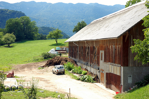
Discover Koroska-Bela in Slovenia
Koroska-Bela in the region of Jesenice with its 2,212 habitants is a place located in Slovenia - some 32 mi or ( 52 km ) North-West of Ljubljana , the country's capital .
Local time in Koroska-Bela is now 03:13 PM (Saturday) . The local timezone is named " Europe/Ljubljana " with a UTC offset of 1 hours. Depending on your mobility, these larger cities might be interesting for you: Sankt Jakob, Ludmannsdorf, Kottmannsdorf, Klagenfurt, and Feistritz im Rosental. When in this area, you might want to check out Sankt Jakob . We discovered some clip posted online . Scroll down to see the most favourite one or select the video collection in the navigation. Are you looking for some initial hints on what might be interesting in Koroska-Bela ? We have collected some references on our attractions page.
Videos
Bled and Bohinj - Slovenia
A settlement area since Mesolithic times, Bled was first mentioned as Ueldes (Veldes) within the March of Carniola on April 10, 1004, when it was awarded by Emperor Henry II to Bishop Albuin I of Brix ..
664-117 in 664-105 na Blejski Bobravi
..
Arkona - Nebo Hmuroe Tuchi Mrachniye (short version)
Arkona - Nebo Hmuroe Tuchi Mrachniye (short version) Arkona is a Russian pagan metal band. Their lyrics are heavily influenced by Russian folklore and Slavic mythology, and their music incorporates se ..
Zdravljica
Recitacija Zdravljice v Vrbi pri Ribčevini ..
Videos provided by Youtube are under the copyright of their owners.
Interesting facts about this location
Ajdna
Ajdna (1064 m) is a peak in the Karavanke in the Municipality of Žirovnica in the Upper Carniola region of Slovenia. Access to it is easiest from the village of Potoki in the neighbouring Jesenice municipality. A settlement from late Antiquity has been found just below the summit and evidence shows that it was probably inhabited much earlier. Excavations began in 1976.
Located at 46.42 14.13 (Lat./Long.); Less than 2 km away
Podmežakla Hall
Podmežakla Hall (Dvorana Podmežakla) is an indoor sporting arena located in Jesenice, Slovenia. It is the home of the HK Acroni Jesenice ice hockey team and its affiliate HD mladi Jesenice. It is also the site of the Triglav Trophy, an annual international figure skating competition held each spring. The name Podmežakla (literally 'below Mežakla') is derived from its location on the southwest bank of the Sava River, directly below the Mežakla Plateau.
Located at 46.43 14.05 (Lat./Long.); Less than 4 km away
Španov vrh
Španov vrh, at 1,361 metres is a peak in the Western Karavanke Alps above the village of Planina pod Golico. Like Golica, it is a popular destination for tourists during the flowering of wild white narcissi, swathes of which cover its pastures in late April and early May. It is visited throughout the year as an easy peak to reach with panoramic views of the Julian Alps and Golica and the surrounding peaks in the Karavanke.
Located at 46.46 14.07 (Lat./Long.); Less than 4 km away
Zabreznica
Zabreznica is one of ten villages in the Municipality of Žirovnica in the Upper Carniola region of Slovenia. It is the location of Žirovnica Primary School, which serves the primary education needs of all the villages in the municipality. Above the village, on the Reber Ridge, the church of St. Lawrence was rebuilt in the 1990s on the foundations of a Romanesque church that was demolished in 1821. It is decorated with work by the contemporary Slovene artists France Bernik and Andrej Jemec.
Located at 46.40 14.15 (Lat./Long.); Less than 5 km away
Stol (mountain)
Stol is the highest mountain in the Karavanke mountain range of the Southern Limestone Alps. Its peak is known as Hochstuhl (German for 'High Chair') or Veliki Stol (Slovene for 'Great Chair') and has the elevation of 2,236 m . The border between Slovenia and Austria runs along the ridge of the mountain, and the peak is located on the Austrian side. The first ascent was made in 1794 by Carniolan Count Franz von Hohenwart.
Located at 46.43 14.17 (Lat./Long.); Less than 5 km away
Pictures
Historical Weather
Related Locations


Information of geographic nature is based on public data provided by geonames.org, CIA world facts book, Unesco, DBpedia and wikipedia. Weather is based on NOAA GFS.