Discover Canfranc in Spain
Canfranc in the region of Aragon with its 589 habitants is a town located in Spain - some 228 mi or ( 368 km ) North-East of Madrid , the country's capital .
Local time in Canfranc is now 05:50 AM (Sunday) . The local timezone is named " Europe/Madrid " with a UTC offset of 1 hours. Depending on your flexibility, these larger cities might be interesting for you: Tarbes, Pau, Limoges, Clermont-Ferrand, and Bordeaux. When in this area, you might want to check out Tarbes . We found some clip posted online . Scroll down to see the most favourite one or select the video collection in the navigation. Are you looking for some initial hints on what might be interesting in Canfranc ? We have collected some references on our attractions page.
Videos
MUNDIAL DE PESCA JACA 2003
www.amoscaguias.com huesca mundial 2003, World Fly Fishing Championship 2003 ..
Pyrenees-Col du Somport-2010-05-11
Col du Somport, 2010 May 11th. This video is in full quality and an updated version of the one that I had uploaded from our hotel in Montory. On our way to Spain on this tour we were taking the pass C ..
Col du Somport - Meggy - 2010-05-18
On our Pyrenees tour from France to Spain we were taking the pass Col du Somport instead of the tunnel. We had taken the pass already a week earlier with our friends and I had video taped them from be ..
X-Adventure Puyarruego 2011
Spanish Pyrenees Extreme canyoning with X-Adventure Escalona, puyarruego, Ainsa ..
Videos provided by Youtube are under the copyright of their owners.
Interesting facts about this location
Canfranc
Canfranc is a municipality in the Aragon Valley of north-eastern Spain consisting of two towns.
Located at 42.72 -0.53 (Lat./Long.); Less than 0 km away
Villanúa
Villanúa is a Pyrenean municipality in Spain in the north of Huesca province, in la Jacetania, set where the Aragon valley gets wider. Its name refers to the "new village" repopulated in the late 10th century. Altitude 953m. and 58.2 km². The village is at the bottom of the mount Collarada (2886m. ) and in 2012 had 499 inhabitants. It is a tourist locality located between Jaca and the ski stations of Candanchú and Astún and near the French border (12 km. by the Tunnel of Somport).
Located at 42.68 -0.53 (Lat./Long.); Less than 4 km away
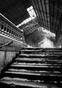
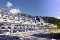
Canfranc International railway station
Canfranc is a former international railway station in the village of Canfranc in the Spanish Pyrenees, at one end of the tunnel which carried the Pau to Canfranc line under the Pyrenees.
Located at 42.75 -0.51 (Lat./Long.); Less than 4 km away
Zapatilla
Zapatilla is a peak in the Pyrenees mountain range. It is located on the Spanish side of the border with France, near the ski resort of Candanchu. It has an elevation of 2450 metres . The mountain Aspe is next to Zapatilla.
Located at 42.78 -0.55 (Lat./Long.); Less than 7 km away
Monastery of San Adrián de Sasabe
The Monastery of San Adrián de Sasabe (Spanish: Monasterio de San Adrián de Sasabe), is a former monastery or hermitage in Aragon, Spain, established in the 9th century, of which only the small Romanesque church now survives.
Located at 42.68 -0.59 (Lat./Long.); Less than 7 km away
Pictures
Related Locations
Information of geographic nature is based on public data provided by geonames.org, CIA world facts book, Unesco, DBpedia and wikipedia. Weather is based on NOAA GFS.


