-
You are here:
- Homepage »
- Spain »
- Canary Islands » Ingenio

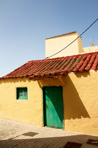
Ingenio Destination Guide
Delve into Ingenio in Spain
Ingenio in the region of Canary Islands with its 29,319 residents is located in Spain - some 1,091 mi or ( 1756 km ) South-West of Madrid , the country's capital .
Local time in Ingenio is now 09:53 PM (Saturday) . The local timezone is named " Atlantic/Canary " with a UTC offset of 0 hours. Depending on your mobility, these larger destinations might be interesting for you: El Aaiún, Vega de San Mateo, Valleseco, Teror, and Tegueste. While being here, you might want to check out El Aaiún . We discovered some clip posted online . Scroll down to see the most favourite one or select the video collection in the navigation. Are you curious about the possible sightseeing spots and facts in Ingenio ? We have collected some references on our attractions page.
Videos
Super Ferrari módena
Vuelta en el buga de mi viejo ..
Ryanair landing at Las Palmas Gran Canaria 11:20am 10/05/2010, Departed from Liverpool
Landing at Las Palmas Gran Canaria at around11:20am 10/05/2010. Flight number FR3801 Ryanair. We stayed in Puerto rico ..
First Choice Airways Airbus A320 take off
First Choice Airways G-OOAP Airbus A320 Take off from Gran Canaria Las Palmas (LPA) to London Gatwick (LGW). May 14th 2007 20:00 (local time) Kylie singing 'I should be so lucky' playing in the backgr ..
COCKPIT VIEW OF APPROACH AND LANDING AT GRAN CANARIA GANDO AIRPORT
Cockpit view of final approach in a windy day at Gran Canaria Gando Airport. ..
Videos provided by Youtube are under the copyright of their owners.
Interesting facts about this location
Ingenio, Las Palmas
Ingenio is a Canarian municipality in the eastern portion of the island of Gran Canaria in the Las Palmas province in the Canary Islands. The population is 26,857, its density is 692.87/km² and the area is 38.15 km². Ingenio is situated between the mountains and the Atlantic Ocean, south of Las Palmas de Gran Canaria and Telde and is accessed with the GC1 highway. The main industries are agriculture and tourism.
Located at 27.92 -15.42 (Lat./Long.); Less than 2 km away
Estadio Municipal de Vecindario
Estadio Municipal de Vecindario is a multi-use stadium in Vecindario, Spain. It is currently used mostly for football matches and is the home ground of UD Vecindario. The stadium holds 4,500 people. The pitch size is 101x64m.
Located at 27.85 -15.45 (Lat./Long.); Less than 8 km away
San Bartolomé de Tirajana
San Bartolomé de Tirajana is a Canarian municipality in the southeastern portion of the island of Gran Canaria in the Las Palmas province in the Canary Islands. San Bartolomé de Tirajana is the largest municipality in area on the island as well as the Canary Islands almost covering between a quarter and one-third of the whole island of Gran Canaria and more than 5 to 6% of the archipelago. The capital is situated in "La Caldera de Las Tirajanas".
Located at 27.93 -15.55 (Lat./Long.); Less than 11 km away
Bandama Caldera
The Bandama Natural Monument is part of the Tafira Protected Landscape on the island of Gran Canaria in the Canary Islands, Spain. It's considered a point of geological interest, because of the Caldera de Bandama. This volcanic caldera reaches 569 m (1,867 ft) above sea level at the highest point on its rim, Pico de Bandama, and is about 1,000 m (3,300 ft) wide and 200 m (700 ft) deep. The steep walk to the bottom of the caldera takes about half an hour.
Located at 28.03 -15.46 (Lat./Long.); Less than 13 km away
Vega de San Mateo, Las Palmas
Vega de San Mateo (latter part Spanish meaning Saint Matthew is a Canarian municipality in the eastern portion of the island of Gran Canaria in the Las Palmas province in the Canary Islands. The population is 7,617, its density is 199.66/km² and the area is 37.89 km². Vega de San Mateo is located SW of Las Palmas de Gran Canaria and W of Telde and is on a road linking to the capital as well as Telde and the northwestern part of Gran Canaria. The main industry are agriculture and tourism.
Located at 28.02 -15.52 (Lat./Long.); Less than 13 km away
Pictures

Related Locations
Information of geographic nature is based on public data provided by geonames.org, CIA world facts book, Unesco, DBpedia and wikipedia. Weather is based on NOAA GFS.