-
You are here:
- Homepage »
- Spain »
- Canary Islands » Carrizal

Carrizal Destination Guide
Touring Carrizal in Spain
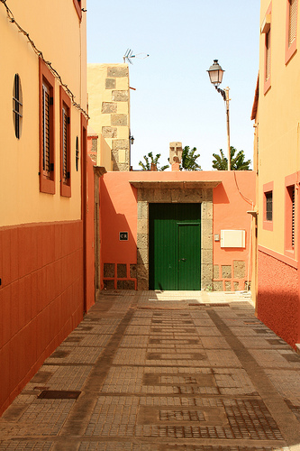
Carrizal in the region of Canary Islands is a city located in Spain - some 1,091 mi or ( 1755 km ) South-West of Madrid , the country's capital city .
Time in Carrizal is now 10:18 AM (Saturday) . The local timezone is named " Atlantic/Canary " with a UTC offset of 0 hours. Depending on your travel resources, these more prominent places might be interesting for you: El Aaiún, Vega de San Mateo, Valsequillo de Gran Canaria, Teror, and Temisas. Being here already, consider visiting El Aaiún . We collected some hobby film on the internet . Scroll down to see the most favourite one or select the video collection in the navigation. Check out our recommendations for Carrizal ? We have collected some references on our attractions page.
Videos
Ryanair landing at Las Palmas Gran Canaria 11:20am 10/05/2010, Departed from Liverpool
Landing at Las Palmas Gran Canaria at around11:20am 10/05/2010. Flight number FR3801 Ryanair. We stayed in Puerto rico ..
COCKPIT VIEW OF APPROACH AND LANDING AT GRAN CANARIA GANDO AIRPORT
Cockpit view of final approach in a windy day at Gran Canaria Gando Airport. ..
Landing at Las Palmas Airport LPA Inside Wiew!! Gran Canaria
Atterraggio volo Charter Blue Panorama con Boeing 737-400 dopo aver effettuato scalo a lanzarote, Arrivati! ..
FINAL APPROACH
Final approach B747-200 IBERIA to Gran Canaria Airport (LPA) ..
Videos provided by Youtube are under the copyright of their owners.
Interesting facts about this location
Ingenio, Las Palmas
Ingenio is a Canarian municipality in the eastern portion of the island of Gran Canaria in the Las Palmas province in the Canary Islands. The population is 26,857, its density is 692.87/km² and the area is 38.15 km². Ingenio is situated between the mountains and the Atlantic Ocean, south of Las Palmas de Gran Canaria and Telde and is accessed with the GC1 highway. The main industries are agriculture and tourism.
Located at 27.92 -15.42 (Lat./Long.); Less than 1 km away
San Bartolomé de Tirajana
San Bartolomé de Tirajana is a Canarian municipality in the southeastern portion of the island of Gran Canaria in the Las Palmas province in the Canary Islands. San Bartolomé de Tirajana is the largest municipality in area on the island as well as the Canary Islands almost covering between a quarter and one-third of the whole island of Gran Canaria and more than 5 to 6% of the archipelago. The capital is situated in "La Caldera de Las Tirajanas".
Located at 27.93 -15.55 (Lat./Long.); Less than 14 km away
Vega de San Mateo, Las Palmas
Vega de San Mateo (latter part Spanish meaning Saint Matthew is a Canarian municipality in the eastern portion of the island of Gran Canaria in the Las Palmas province in the Canary Islands. The population is 7,617, its density is 199.66/km² and the area is 37.89 km². Vega de San Mateo is located SW of Las Palmas de Gran Canaria and W of Telde and is on a road linking to the capital as well as Telde and the northwestern part of Gran Canaria. The main industry are agriculture and tourism.
Located at 28.02 -15.52 (Lat./Long.); Less than 16 km away
Fataga
Fataga is a village in the municipality of San Bartolomé de Tirajana on the island of Gran Canaria (Canary Islands, Spain). Latitude 27°53'15"N, longitude 15°33'50"W. Altitude approx 1980 feet (600 metres) above mean sea level. The village can trace its origins back for more than 2000 years, when the area of the current village was inhabited by the Guanche natives.
Located at 27.88 -15.57 (Lat./Long.); Less than 16 km away
Santa Brígida, Las Palmas
Villa de Santa Brígida is a Canarian municipality in the northeastern portion of the island of Gran Canaria in the Province of Las Palmas of the Canary Islands. The suburbs of Las Palmas. The population is 18,817, its density is 790.3/km² and the area is 23.81 km². It is located by a main highway linking it to the capital - Las Palmas and has access with the superhighway GC3. The main industries are agriculture and tourism especially in the park area.
Located at 28.03 -15.50 (Lat./Long.); Less than 16 km away
Pictures


Related Locations
Information of geographic nature is based on public data provided by geonames.org, CIA world facts book, Unesco, DBpedia and wikipedia. Weather is based on NOAA GFS.