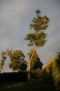
Discover Sankt Olof in Sweden
Sankt Olof in the region of Skåne with its 640 habitants is a place located in Sweden - some 294 mi or ( 474 km ) South-West of Stockholm , the country's capital .
Local time in Sankt Olof is now 05:26 AM (Monday) . The local timezone is named " Europe/Stockholm " with a UTC offset of 1 hours. Depending on your mobility, these larger cities might be interesting for you: Rønne, Copenhagen, Ystad, Vik, and Växjö. When in this area, you might want to check out Rønne . We discovered some clip posted online . Scroll down to see the most favourite one or select the video collection in the navigation. Are you looking for some initial hints on what might be interesting in Sankt Olof ? We have collected some references on our attractions page.
Videos
Steam trains in Sweden 2008
This is the story about the running of a small steam operated railway around the 1950s. The Skånska Järnvägar Preservation Society took over the railway in 1971 and thus became the first veteran railw ..
Jimmy Page, rediscovered rare photos from Safe Sex bootleg gig 1986
On August 4 1986, while on holiday in Ibiza, Jimmy Page played a live gig at the Heartbreak Hotel nightclub in San Antonio. With him on stage was Jason Bonham, on drums, Mike Thompson (vocals), and De ..
Sonic Surf City live in Lund
SSC live på Rock'n'roll-klubben i Lund. Stället att vara på om du gillar rock. ..
Coronet tournament in Attemark
The Nordmark Coronet tournament held in Attemark during St Marten feast ..
Videos provided by Youtube are under the copyright of their owners.
Interesting facts about this location
Österlen
Österlen is the southeastern part of the Swedish province of Scania. The name derives from its location 'east of the route' (ancient route from Ystad, heading north-east); 'Öster om len' ('len' is short for leden, i.e. route). The principal town of Österlen is Simrishamn. It's famous for beautiful nature, small towns, farmland and is a popular tourist attraction. Many songs and poems have been written about Österlen.
Located at 55.63 14.18 (Lat./Long.); Less than 3 km away
The King's Grave
The King's Grave near Kivik (Kungagraven i Kivik, Kiviksgraven) in the southeastern portion of the Swedish province of Skåne is what remains of an unusually grand Nordic Bronze Age double burial c. 1000 BC.
Located at 55.68 14.23 (Lat./Long.); Less than 8 km away
Vitemölla
Vitemölla is a village situated in the southern part of Sweden, in Skåne. It's situated right next to Kivik, and every year there's a market, Kiviks Marknad, between these two villages. The market goes on for three days, and it's very crowded. Most people only live in Vitemölla during summers, but some live there all the time.
Located at 55.70 14.20 (Lat./Long.); Less than 9 km away
Gårdlösa
Gårdlösa is the site of an Iron Age settlement in the parish of Smedstorp in Skåne, Sweden. It was inhabited shortly during the late Nordic Bronze Age, and from the 1st century BC–11th century AD. In 1949, a woman's grave from the Roman Iron Age was found in Gårdlösa. It had a silver fibula on which there was a runic inscription. In 1963–1976, there were archaeological excavations of house foundations, grave fields and a shrine.
Located at 55.55 14.14 (Lat./Long.); Less than 9 km away
Linderödsåsen
The Linderödsåsen is a ridge, geologically a horst, in the province of Skåne in southernmost Sweden. It lies at the edge of the Baltic shield, in the Tornquist zone, and continues with the Hallandsås in north western direction towards the Kattegat. It stretches through Skåne from northwest to southeast. On the map it is situated in the middle of the province.
Located at 55.67 14.27 (Lat./Long.); Less than 9 km away
Pictures
Historical Weather
Related Locations
Information of geographic nature is based on public data provided by geonames.org, CIA world facts book, Unesco, DBpedia and wikipedia. Weather is based on NOAA GFS.


